Showing posts with label protected species. Show all posts

Thursday 19 October 2017

Be a hero - save an endangered Swift Parrot family today


Swift Parrot
Lathamus discolor
Psittacidae
Critically endangered (Australian federal listing)
IUCN Red List
Image: Geoffrey Dabb/ Canberra Birds

Swift Parrots breed only in Tasmania and then fly across Bass Strait to forage on the flowering eucalypts in open box–ironbark forests of the Australian mainland. While on the mainland, they are nomadic, spending weeks or months at some sites and only a few hours at others, determined by the supply of nectar. [Birdlife Australia]


Go to https://pozible.com/project/operation-pko to donate

ABC News, 18 October 2017:

The parrots are nomadic and eat nectar, travelling in flocks to nest near flowering eucalypts.
"This year, all their food is on the east coast of Tasmania, and that area is full of sugar gliders," Dr Stojanovic said.
"We're very concerned that all the birds we bred on predator-free islands last year, will end up nesting on the mainland in sugar glider habitat and be eaten."
With the help of an electrician, Dr Stojanovic has designed "a possum-keeper-outer" nest boxes, with a door to close behind the parrot once darkness fell.
"Effectively, it's just a little motor and a light sensor," he said.
"As soon as it's daytime the sensor automatically detects that there's ambient light and it will open to release the parrot to go about their business….
Dr Stojanovic said previous research had shown the possums could eat parrots "within a couple of days" of the bird laying its eggs.
"About half of the female swift parrots that nest on the mainland of Tasmania each year end up being eaten by sugar gliders," he said.
"It can be a really severe rate of predation."
Dr Stojanovic said the crowd-funding protection measures were needed due to ongoing deforestation of the swift parrot habitat, by logging.

Monday 16 October 2017

Update on the proposed 140 lot community title residential subdivision in Hickey Street, Iluka, NSW


Hickey Street and environs in Iluka at the mouth of the Clarence River

The proposed 140 lot community title residential subdivision in Hickey Street, Iluka, NSW was declared a controlled action on 6 October 2017 and, as such, requires assessment under the Environment Protection and Biodiversity Conservation Act 1999 and ministerial approval before it can proceed.

According to Australian Government Dept. of  Environment and Energy the relevant controlling provisions are:

World Heritage properties (sections 12 & 15A)
National Heritage places (sections 15B & 15C)
Listed threatened species and communities (sections 18 & 18A)

There are five levels of controlled action assessment provided under the Act and the development proposal assessment for this subdivision will be by preliminary documentation, due to it being considered a proposal where the impacts are localised, easily predicted or where the impacts have already been adequately assessed under other legislation.

It is the responsibility of the development applicant, Stevens Holdings Pty Limited, to prepare documentation to support the assessment process.

Preliminary documentation assessment is one of the four levels requiring a public comment phase as part of the process. The availability of assessment documentation for public comment will be advertised in the relevant press and on the Department's website.

Monday 2 October 2017

Iluka Real Estate decided to tout a proposed development and instead stirred up the local community


Perhaps thinking to further his own commercial interests and apply a little pressure to the Northern Joint Regional Planning Panel (NJRPP) currently considering a proposed 140 lot development on environmentally sensitive land, Iluka Real Estate owner Graeme Lynn took to the airwaves on 26 September 2017 spruiking this development which he has been advertising online since  2015.

Unfortunately for Mr. Lynn all he did was demonstrate that the Iluka community is not happy with the scale and design of this development application, as well as concerned with loss of biodiversity and habitat – particularly destruction of a Coastal Cypress Pine Endangered Ecological Community (EEC), loss of local koala habitat and fragmentation of a known wildlife corridor.

Up to the point that Mr. Lynn rose to his feet at the NJRPP Public Briefing Meeting on 20 September, the community debate on this planning issue had remained civil and constructive. Most Iluka residents are obviously trying to ensure it stays that way.

Here is how the online response to Mr. Lynn's on-air statements played out:


DEVELOPMENT PLAN DIVIDES ILUKA

Opponents of a major residential subdivision planned for Iluka say it puts the village's unique charm at risk.

The Birrigan Gargle Local Aboriginal Land Council has been working with the Stevens Group on a 140-lot development on Hickey Street.

The state's Joint Regional Planning Panel hosted a public briefing on the issue last week.

Tony Belton, from the Association of Iluka Residents, said it was a huge project which threatened the character of the village.

"Iluka has so far avoided the over-commercialised coastal development that now characterises many seaside destinations," he said.

"And I think that sort of sums it up, people come here for that unique coastal experience that sadly has largely been lost due to over development.

"One speaker at the meeting the other day said this kind of development would be more suitable for a place like Mount Druitt. 

"And indeed that's the issue, it's a huge development with little consideration for the world-heritage status next door or for the feel of Iluka as it is now."

But not everyone is opposed.

The President of the Iluka Ratepayers Association, Graeme Lynn, said residents could see benefits in the proposal.

The shops here need more customers," he said.

"The golf club is right next door and it definitely needs more customers and it'll give better access to the golf club ... coming all the way through. 

"And the shops in town need those extra customers."

A spokesperson for Birrigan Gargle Land Council declined to speak with the ABC until after the development application had been finalised.


14 comments
Comments
Roslyn Woodward Grahame Lynne is not only from Iluka real estate, he is also the president of the Iluka golf club, president of the association of Iluka residents and president of the Iluka Rotary. He spoke at the judicial panel meeting but did not declare he had an obvious financial interest. This map clearly shows the proximity to the World Heritage Area on the other side of Iluka Rd and the important east-west wildlife corridor link to the Clarence River. There are many threatened species on the site and lots of Koala sightings. The land council may need funds we are not to question that - but this land could certainly qualify for a biodiversity off-set which would be a win for the land council, Iluka's amenity and wildlife.
6 · 19 hrs
Jill Garsden Oh, no, please, no......Iluka is the only north coast coastal town we can retreat to without feeling that it's become too overdeveloped and touristy. Its charm and attraction lies in the fact that it has withstood further development. If it becomes like every other coastal town then it will lose not only our regular visits, but also those of many others.
2 · 17 hrs
Annie Leggett Well of course Graeme Lynn thinks it's a great idea.... he is the real estate agent working with the developer to sell the land/development.... good for him sure.... lots of money in it for him.... Good for the people of Iluka ?? Now that is a better question? If you listen to others, who aren't just focused on the money .... there are many things that are not okay about the development in its current proposal.
Tania Laurie What's wrong with all you Anti-development activists. The fact of the matter is that the population is growing and more housing is required. Don't you realize that there were native flora and fauna once where houses are now. As stated, heritage listed land is near so these species will move to safer habitat, not be wiped out. And it would be a disgrace to think all this opposition is because the Aboriginal land Council is involved. Eventually communities have to grow to help accommodate existing residents family as they get older and will help keep communities family orientated. Besides all that, it's a great economic injection for the town. Wake up and stop whinging.
1 · 17 hrs
Louise Devonforlunch No mention is made of the fact there have been four gravesites discovered. Two are located on the DA site and two opposite on the crown land. Ground Penetrating Radar undertaken during the Heritage study confirmed one of the gravesites had an 9/10 chance of containing human remains but despite this the site was excavated recently to the extent that one of the most intact gravesites has been destroyed beyond recognition!
Dave Schwarz You'd have to wonder what the Land Council is up to, seems the mighty $ is more important than the precious land? I'm no Greenie, but the argument the shops need more customers is surely crazy, surely the residents need fewer shops? 
Carol Watkins ILUKA CEMETERY 
Elizabeth Street 
Iluka NSW 2466
The Iluka Cemetery has been subdivided into a lot of about .3 ha and is believed to contain three bodies. The graves are thought to be located on the crest of a small sand dune about 20 metres off the northern side of Elizabeth Street. The site of the graves is covered with scrub vegetation. Only one grave is marked with a wooden cross and it bears the name of Earnest Eaton. Graves are not visible from the road. A memorial wall is located on the same side of the road about 100 metres away.
https://www.clarence.nsw.gov.au/cp_themes/metro/page.asp...
Peter Appleton One thing that surprised me with the original DA, listed by council on Christmas Eve 2015, is that they appeared to be unaware that this is an historic sand mining site. Seems strange to me as there are records and maps everywhere saying its been sand mined. As I understand it a Section 149 Certificate is a legal document issued by NSW councils under the EPA Act which gives detailed information about sites. The Clarence Valley Council (CVC) Section 149(2) Certificate issued for this site (as per the released DA material) does not mention the sand mining history of the site. Page 10 of the certificate says, "Council records do not have sufficient information about previous use of this land to determine if the land is contaminated." The engineering consultants engaged by the developer (Cardno Pty Ltd) then seem to run with this in their 8 August 2015 report which says on page 5, "There is no available evidence of land clearing, mining infrastructure, mining pits or dredging ponds in the aerial photography, which suggests that no mining, or on site separation processes were conducted on site." Seriously??? Cardno would then appear NOT to have undertaken any soil samples with regards to Zircon, Rutile or any of the other associated sand mining minerals.
Louise Devonforlunch Yes the original Cemetery was near Sid & Eileen Gill Park however the DA site was set aside as an additional cemetery between 1910 and 1928 when it was returned to Crown Land. The gravesites that were found at the South Western end of the DA site about 100m from each other. There are four in total but now since one has been destroyed only three remain. This is a part of Iluka’s history and whether they are Aboriginal or European they warrant further investigation and respectfully treated not subjected to the heavy handed approach used recently by the Police as I understand it.
Peter Appleton As you know Louise the one that has been destroyed was mentioned at a JRPP briefing meeting at Clarence Valley Council offices on 16 August 2017. In attendance were panel members Garry West (Chair), Stephen Gow, Jim Simmons, Jason Kingsley. Apologies from Pam Westing. Also in attendance were council assessment staff Carmen Landers (Development Planner) and Nigel Sutton (Development Engineer). "Key Issues Discussed" included "Aboriginal Burial Site". 
No cultural heritage or aboriginal heritage reports were presented with either the original or amended DA, despite council being advised via submissions of the likely presence on site of at least one aboriginal gravesite. This latest round of submissions commenced before the completion of both the Extent Heritage "Aboriginal Cultural Heritage Assessment" and "Baseline Historical Archaeological Assessment" reports. These reports were released to submitters only after they complained about their absence and were then only forwarded by council to two submitters that I am aware of. 
My email to council following this incident includes, "Were the local police involved in this operation advised by council that this site is currently subject to a development application and has been referred to the commonwealth with a decision still pending as to whether it becomes a controlled action? Were police advised by council that this is likely to be an aboriginal grave that they were bulldozing or is this something that council still wishes to dispute? Were police advised that this part of the DA site was an area described by the ecological consultant for the applicant as being the best example on site of the endangered ecological community Callitris columellaris? Were police advised that this is an historic sand mining site with the potential for radioactive concentrations of mineral sands to be found beneath the surface?" 
The excavator operator (a local) was left unsupervised to backfill after the excavation, was wearing no safety equipment, face mask etc and advised that he had excavated to a depth of 2 metres.

Saturday 23 September 2017

An NJRPP Public Briefing Meeting in Iluka, NSW, 20 September 2017


Section of the southern boundary of the Hickey Street land proposed for development

On 21 September 2017 North Coast Voices received this email from an Iluka resident on the subject of a recent meeting in that little coastal town:

At 4.30pm on Wednesday 20th September 2017 the Northern Joint Regional Planning Panel (NJRPP) held a Public Briefing Meeting at Iluka Community Hall concerning the proposed coastal subdivision of 19 hectares of environmentally sensitive land adjacent to the Iluka World Heritage Area.

The meeting was chaired by Gary West (Chair NJRPP) who was accompanied by three other panel members - Ms. Pam Westing, Clarence Valley Mayor Jim Simmons and Deputy-Mayor Jason Kingsley.

Four council staff members accompanied the panel members, including Carmel Landers who is responsible for progressing the development application through council planning processes.

Concerned residents and ratepayers filled between half and three-quarters of the hall’s seating capacity.

A number of people from the Yaegl community were present, as well as Cr. Greg Clancy who was there in a personal capacity.

The Panel secretariat had invited individuals and groups who had made formal submissions on the proposed development to register beforehand as speakers.

Around nine listed speakers presented their views and most called attention to significant problems with the development application – including street design, lot density, stormwater drainage and nutrient load, as well as loss of tree cover and habitat in the current version of this 140 lot urban development.

The Association of Iluka Residents (AIR Inc) were first off in the order of speakers. Its President introduced the issues, the Secretary expanded on key concerns, and one of AIR's members presented questions to the developer (in absentia) via the panel and Council staff, then the President wrapped up the AIR presentation.

John Edwards on behalf of the Clarence Environment Centre spoke with some authority on issues of concern regarding the proposed development.

Also rising to their feet were local residents Kay Jeffrey and Gabrielle Barto.

Ms. Jeffrey spoke very eloquently from the heart about Land Care on the World Heritage site which contains rare littoral rainforest, pointing out this development would be detrimental to flora and fauna within that site. Expressing her gratification that evidence now showed the koala was not functionally extinct in Iluka. She further pointed out that the type of development proposed was better suited to outer metropolitan urban areas such as Mt. Druitt.

While Ms. Barto spoke with a deal of on-the-ground knowledge on a range of environmental and planning concerns. She highlighted the fact that sightings of koala on and in the vicinity of the land in question demonstrated that this large lot was being used as part of a larger movement corridor.

A retired real estate agent originally from Bribie Island stated he didn't want Iluka to turn into a Bribie Island or Lennox Head, having had firsthand experience of what can happen if poorly planned developments are allowed in coastal towns. Additionally, he spoke of the problems associated with community title – in particular that by-laws and management plans on community title could be changed over time.

Another speaker suggested the development site would be suitable for acquisition by the NSW Government in order to protect the local koala population and koala habitat. Something it has apparently undertaken in the Tweed Heads region.

Grahame Lynn (who was approx.10 minutes late) was the last scheduled speaker as President of the Iluka Ratepayers Association (IRA). He proceeded to attack with some vigour the Clarence Environment Centre submission as well as those of many other individuals and groups that oppose this development. Indeed he spent most of the time in attack mode and very little time in talking up the proposed development.

Mr. Lynn as a local real estate agent has been advertising the proposed subdivision for at least the last eighteen months  – a potential conflict of interest he failed to mention to the panel. 

It was noted that up until that point, all panel members and Council staff were taking copious notes, but as soon as he started talking they stopped. I guess one loses credibility when attacking the “player and not the ball” so to speak.

By the end of the meeting I was of the opinion that Gary West as Chair had run the meeting well, making us all feel comfortable and all points of view were heard.

Anon
Iluka, NSW

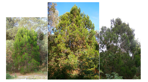
Coastal Cypress Pine on the development site
Images supplied by Iluka resident

Monday 17 July 2017

'The Force' is strong on the Liverpool Plains


People power at work on the NSW Liverpool Plains -  well done to everyone over the years who attended protest events, emailed, wrote, phoned. posted, tweeted and/or made formal submissions objecting to Shenhua’s mining expansion plans.


Shenhua says it still plans to progress the Watermark coal mine in light of the NSW government $262m buy back of half its exploration licence.

Shenhua Australia Chairman Liu Xiang said the planning for the mine would continue on the remaining section of the licence “in line with the planning approvals” from both the state and federal governments.

The NSW government said despite the agreement, Shenhua's expired exploration licence had yet to be renewed.

“An application to amend the current renewal application to remove the relinquished area has been received,” a Department of Planning and Environment spokesman said.

“The relinquished area will be removed from the title and the consideration of the renewal application for the remainder of the licence will be considered as per normal procedures and in accordance with the Act.”

In a statement to The Leader, Shenhua expressed its “disappointment” regarding the NSW government’s stance on mining operations on black soil plains, “as it would prevent its efforts” to get its exploration licence “wholly renewed”.

While Shenhua believes it “would have been able to responsibly expand its existing Watermark Coal Mine”, it has “come to terms with the NSW Government’s decision to not allow any mining on the black soil plains”.


However, the fight continues…….


Liberal Member of the NSW Legislative Council, Don Harwin
Minister for Resources, Minister for Energy and Utilities, and Minister for the Arts, Vice-President of the Executive Council
Phone
(02) 8574 7200
Fax
(02) 9339 5568
Email


ABC News, 12 July 2017:

National co-ordinator for the Lock the Gate Alliance Phil Laird said anything less than the full cancellation of the project would not protect the farming systems.

"If we are going to hand over our best farming country to a coal mine that's owned by the Chinese Government, we've got to change our priorities," Mr Laird said.

"This coal mine is going to be 200 metres deep and its going to cut below the ridge line way below the level of the farm land and the aquifers.

"The impacts to those aquifers is unknown and the entire region depends on those aquifers for survival."


CSEC - CHINA SHENHUA ENERGY COMPANY LTD.
12/07/2017 | Press release | Distributed by Public on 12/07/2017 19:28

Voluntary Announcement- Announcement On Progress Of The Wate...

Hong Kong Exchanges and Clearing Limited and The Stock Exchange of Hong Kong Limited takes no responsibility for the contents of this announcement, makes no representation as to its accuracy or completeness and expressly disclaims any liability whatsoever for any loss howsoever arising from or in reliance upon the whole or any part of the contents of this announcement.
(a joint stock limited company incorporated in the People's Republic of China with limited liability)

(STOCK CODE: 01088)
VOLUNTARY ANNOUNCEMENT
ANNOUNCEMENT ON PROGRESS OF THE WATERMARK PROJECT

This announcement is made by China Shenhua Energy Company Limited (the "Company") on a voluntary basis. The purpose of this announcement is to keep the Shareholders and potential investors of the Company informed of the latest business development of the Group.

On 20 November 2008, the Company issued the Announcement in relation to Watermark Exploration Area Exploration License. Shenhua Watermark Coal Pty Limited ("Watermark Pty"), a wholly-owned subsidiary of the Company, entered into Exploration License with the state government of New South Wales, Australia (the "NSW Government"), pursuant to which Watermark Pty paid for the exploration license at a consideration of AUD299,900,000 and obtained the Watermark exploration area of approximately 195 square kilometers in aggregate.

On 29 June 2017, Watermark Pty reached an agreement with the NSW Government in relation to partial extension of the exploration license. Pursuant to the established policies of protection of agricultural activities on the black soil plains, the NSW Government withdrew the exploration license of approximately 100 square kilometres within Watermark exploration area and provided Watermark Pty with economic compensation amounting to AUD261,800,000, and accepted the application for the partial extension of the exploration license of non-black soil plains in Watermark exploration area. According to the agreement upon tendering in 2008, if the mining license of Watermark Pty is approved, then an additional AUD200,000,000 shall be paid to the NSW Government.

There are three planning open-cut mining areas, which are situated within the area of non-black soil plains, for the Watermark Pty Open-cut Coal Mine Project with recoverable reserves of approximately 290 million tonnes (JORC Standards), total designed raw coal production capacity of 10 million tonnes/year and designed service life of 24 years. The total investment amount of the project was approximately AUD1,470,000,000, among which 40% was contributed by Watermark Pty and 60% was financed by way of bank borrowings.

Up to now, the approval from the National Development and Reform Commission of the PRC, the approval for the environmental impact assessment from the Australian Federal Government and the approval from the Planning and Assessment Commission of the NSW Government have been obtained for the Open-cut Coal Mine Project. The environmental protection certification and mining rights license from the NSW Government will be applied for.

Watermark Pty will comply with the requirements of laws in Australia to promote the approval and construction of the Open-cut Coal Mine Project.

SHAREHOLDERS OF THE COMPANY AND POTENTIAL INVESTORS ARE ADVISED TO PAY ATTENTION TO INVESTMENT RISKS AND EXERCISE IN CAUTION WHEN DEALING IN THE SHARES OF THE COMPANY.

By Order of the Board
CHINA SHENHUA ENERGY COMPANY LIMITED HUANG QING
Secretary of the Board of Directors

Beijing, 12 July 2017

As at the date of this announcement, the Board comprises the following: Dr. Ling Wen, Dr. Han Jianguo and Dr. Li Dong as executive directors, Mr. Zhao Jibin as non- executive director, and Dr. Tam Wai Chu, Maria, Dr. Jiang Bo and Ms. Zhong Yingjie, Christina as independent non-executive directors.

It should be noted that the Shenhua Group has been named as one of the top 100 global fossil fuel companies collectively resposible for 72% of all global industrial Green House Gas (GHG) emissions.

Sunday 23 April 2017

Australia has the highest rate of land clearing in the developed world, according to the Dept. of Intergenerational Theft


Australia has a land mass of 149,50,000 km2 or est. 14.94 billion hectares.

According to the FOOD AND AGRICULTURE ORGANIZATION OF THE UNITED NATIONS, GLOBAL FOREST RESOURCES ASSESSMENT 2015 the following figures are fact:

In 2015 only 16.2  per cent of Australia’s land mass was forest and another 32.7 per cent had another form of tree cover.

There are now only 5 million hectares of primary forest remaining in this country and we are losing an est. 201,600 hectares of this type of forest each year, principally due to commercial logging.

Mangroves now cover only 913,000 hectares of coastal land.

Introduced species tree cover, presumably for commercial forestry and orchards, totalled 1.02 million hectares in 2015.

Monday 3 April 2017

Six foot tall heavyweight Barnaby Joyce versus thirteen inches of Australian possum magic


A red-faced political brawler has decided to beat up on a shy, small nocturnal possum.

THE POSSUM

Gymnobelideus leadbeateri

Native to Australia
Originally known as the Bass River Possum
Estimated average length: 33 cm (13 inches) from head to tail

Critically Endangered (2015)
On International Union for Conservation of Nature (IUCN) Red List of Threatened Species
Estimated wild population: 1,200 - 4,000 possums

Leadbeater's possum occurs in Australia’s tallest forests in central Victoria. Considered extinct until 1961, the species is now found in two subpopulations: a core location in the Central Highlands and an outlier in lowland floodplain forest. During the day, possums den in communal nests in the hollow centre of a large dead or living tree. A monogamous breeding pair and one or more generations of offspring den together. Feeding occurs at night with the diet comprising of trunk and branch exudates (80%) and insects (20%). [Australian Department of Environment and Energy, Species Profile and Threats Database, 2017]

Old-growth ash forest is prime habitat for Leadbeater’s possum. It is estimated that old-growth or multi-aged mountain ash forest comprised 30–60 per cent of the current ash forest estate in the Central Highlands of Victoria prior to European settlement. Old growth ash forest now comprises 1.15 per cent of this mountain ash forest estate (Lindenmayer et al., 2013a). [Threatened Species Scientific Committee, Conservation Advice to the Minister, 22 April 2015]

Bushfires, post-fire salvage logging and commercial timber harvesting, particularly clear-felling, are the principal cause of continuing loss of ideal habitat.

The Leadbeater’s Possum is the gazetted mammal emblem of Victoria [1971].

* Image of Joyce letter via Twitter

* Leadbeater's Possum photograph from auscape.com.au

* Photograph of Barnaby Joyce from Google Images