Showing posts with label weather. Show all posts

Thursday 17 February 2011

Life's little lessons learnt from Cyclone Yasi


Drought-driven dust storms, tropical cyclones, east coast lows, out-of-nowhere tornadoes, storm surges, floods, bush fire - it seems Australia has seen them all over the last twelve months, so this blog post reprinted with kind permission of Island View over at Blogging Townsville contains some hints for the disaster next time......

What I learnt from Cyclone Yasi

While Yasi's winds here were equivalent to a severe Category 2 or weak Cat. 3 cyclone there are some useful things I learnt (or were reminded of) for next time:

  1. The wind follows the land - the gullies and valleys - just as fires and flash floods do
  2. Get a manual coffee grinder
  3. Solar houses don't have to wait for the power to come on
  4. Get an alternative mobile phone charger - car, solar, wind-up, whatever
  5. A surprising number of people build stupid houses in stupid places
  6. Building on or immediately behind the foreshore dune is dumb - it's a sand dune for god's sake! It has a purpose - to move, to replenish the beach!
  7. The ONLY media that works/adds value in a crisis is local ABC radio and a battery powered receiver - it must be defended at all costs
  8. There is no such thing as too much duct tape
  9. Don't assume that because there's a cyclone, it's gonna rain - fill the bath all the way
  10. Emergency alert text messages are great - if you have a mobile
  11. Charge the camera beforehand - taking pics on the mobile chews up battery time
  12. Tell everyone beforehand to only text you and not to ring
  13. Get more ice beforehand, fill the fridge up with it (unless you have a solar house of course)
  14. The Internet is invaluable until you lose power - but only because in enables you to track the cyclone closely.
  15. News sites are hopeless and Facebook is downright dangerous in the hands of a teenager who can't discern rumour from fact or possibility from probability.
  16. Print media is useless unless they can can get an edition out before the power comes on
  17. The BOM site is fantastic but I suspect most people don't know how to read the forecast maps
  18. Most people have no idea of the country on which they live or how it works
  19. Most people (and journalists) have no appreciation of the geography of Queensland
  20. Don't wait for the last minute to buy your beer supply and when you do don't forget to get extra for all of those chats with the neighbours after
  21. Always be nice to the Ergon and CityWater guys - they are worth their weight in beer at the very least. They do an amazing job in appalling conditions
And finally, when everyone is locked down and until the storm passes, you are starkly reminded that ultimately in this world, you are on your own baby.


Magnetic Island, 9 February 2011

Tuesday 8 February 2011

Looking at the gestation window for a new cyclone?


Tropical cyclones
Tropical cyclones are low pressure systems that form over warm tropical waters and have well defined wind circulations of at least gale force strength (sustained winds of 63 km/h or greater with gusts in excess of 90 km/h).
Technically they are defined as a non-frontal low pressure system of synoptic scale developing over warm waters having organised convection and a maximum mean wind speed of 34 knots or greater extending more than half-way around near the centre and persisting for at least six hours....
The severity of a tropical cyclone is described in terms of categories ranging from 1 to 5 related to the zone of maximum winds.....
Australia continues to feel the effects of one of the strongest La Niña's on record. During La Niña events, tropical cyclone numbers are typically higher than normal during the November to April period, while summer daytime temperatures are often below average, particuarly in areas experiencing excess rainfall.....
Climate indicators of ENSO continue to indicate a strong, mature La Niña, although there are clear signs the event has passed its peak. Pacific Ocean temperatures have increased, especially below the surface, while atmospheric indicators such as the Southern Oscillation Index (SOI), trade winds and cloud patterns have eased from their peaks reached about a month ago......
These observations are consistent with long-range forecast models surveyed by the Bureau which show the Pacific gradually warming during the southern autumn. Given that March to June is the ENSO transition period, there is a spread among the model predictions for the middle of 2011. The most likely outcome is for a return to neutral conditions, but there is a chance of La Niña persisting for the rest of the year.


Australian Bureau of Meteorology sea surface temperature mapping on February 3 2011


Exceeding mean temperature probability February-April 2011

TROPICAL CYCLONE IMPACTS ALONG THE AUSTRALIAN EAST COAST FROM NOVEMBER TO APRIL 1858 TO 2000


La Niña - Detailed Australian Analysis

Saturday 29 January 2011

What have we all done to deserve this?


One might well ask; "What have we all done to deserve this?". As a Cat 3 cyclone bears down on the main urban areas of West Australia and, not one but two cyclones are predicted to be heading for northern Queensland between tomorrow and Thursday next.

What we definitely don't deserve is Opposition Leader Tony Abbott's persistent politicking over the rolling natural disaster January 2011 has become.

His offer to sit down with the Prime Minister and find an additional $1.8 billion in savings to save our country from yet another tax grab is an insult to voter intelligence when everyone knows government does not need opposing political parties' permission or endorsement to make budget cuts.

Australian Bureau of Meteorology maps on 29 January 2011:

Saturday 15 January 2011

How Eastern Australia begins its Saturday 15 January 2011


From the Bureau of Meteorology webpage National Warnings Summary:

Queensland

Warnings current:

High Seas Warning for TC Zelia,

Tropical Cyclone Information Bulletin for TC Zelia,

Ocean Wind Warning from Fiji,

Ocean Wind Warning from NZ,

Flood Warning - Fitzroy River,

Flood Warning - Burnett River,

Flood Warning - Mary River,

Flood Warning - Lockyer, Bremer, Warrill & Brisbane below Wivenhoe.,

Flood Warning - Logan-Albert,

Flood Warning - Condamine-Balonne Rivers,

Flood Warning - Macintyre/Weir,

Flood Warning - Moonie River,

Flood Warning - Thomson/Barcoo/Cooper Ck,

Queensland flood warning summary,

Forecast Track Map (QLD) for TC Zelia.

NSW and ACT

Warnings current:

Coastal Waters Wind Warning for New South Wales waters between Port Stephens and Point Perpendicular, between Moruya Heads and Gabo Island,

Cancellation of Severe Weather Warning for Snowy Mountains forecast district,

Flood Warning - Richmond/Wilsons,

Flood Warning - Clarence River,

Flood Warning - MacIntyre River,

Flood Warning - Macquarie River,

Flood Warning - Bogan River,

Flood Warning - Murrumbidgee River,

Flood Warning - Murray River,

Flood Warning - Culgoa, Bokhara, Narran,

Flood Warning - Warrego River,

Flood Warning - Barwon-Darling US Bourke,

Norfolk Island Tropical Cyclone Advice for TC Vania,

Ocean Wind Warning 1 - South Eastern area.

Victoria

Warnings current:

Coastal Waters Wind Warning for Victorian waters between Mallacoota and 60nm east of Gabo Island,

Brown Rot Advice for Northern Country, North Central and North East forecast districts,

Cancellation of Severe Weather Warning for East Gippsland and North East forecast districts,

Flood Watch for Greater Melbourne,

Flood Watch for Barwon, Hovells Creek and Otway Ranges,

Flood Watch for the Glenelg and Hopkins Basins,

Flood Watch for North East Victoria,

Flood Watch for the Goulburn and Broken Basins,

Victoria Flood Warning Summary,

Flood Warning - Maribyrnong River,

Flood Warning - Yarra River,

Flood Warning - Dandenong,

Flood Warning - Werribee River,

Flood Warning - Barwon River,

Flood Warning - Hopkins River,

Flood Warning - Glenelg River,

Flood Warning - Ovens and King Rivers,

Flood Warning - Broken River,

Flood warning for Seven Creeks / Castle Creek,

Flood Warning - Goulburn River,

Flood Warning - Campaspe River,

Flood Warning - Loddon River,

Flood Warning - Avoca River,

Flood Warning - Wimmera River,

Flood Warning - Murray River,

Ocean Wind Warning 1 - South Eastern area.

Tasmania

Warnings current:

Coastal wind warning 1,

Boating Weather - Wind Alert SW and Central Plateau Lakes,

Flood Warning Summary,

Flood Warning - Forth/Mersey,

Flood Warning - Meander,

Flood Warning - North Esk,

Flood Warning - South Esk,

Flood Warning - Macquarie,

Flood Watch Advice,

Severe Weather Warning 2,

Road Weather Alert,

Ocean Wind Warning 1 - South Eastern area.

This page last updated at:-
Friday January 14 2011 13:36 UTC (GMT) -- January 14 2011 21:36 WST -- January 14 2011 23:06 CST -- January 15 2011 00:06 CDT -- January 14 2011 23:36 EST -- January 15 2011 00:36 EDT

Thursday 6 January 2011

Albanese talks with NSW North Coast mayors about flooding


The Federal Labor Member for Page, Janelle Saffin’s timely media alert, as the NSW North Coast and Mid-North Coast face a day of predicted severe weather and chance of flash flooding:

Infrastructure and Transport Minister Anthony Albanese is on the NSW North Coast and will hold a doorstop following a briefing from local mayors about the impact of the recent floods.

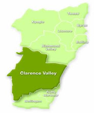
The following mayors will be attendance: Jennifer Dowell (Lismore), Ernie Bennett (Kyogle), Phillip Silver (Ballina), Col Sullivan (Richmond Valley) and Richie Williamson (Clarence Valley).

Google Images photograph of Saffin and Abanese in less stressful times on the North Coast

Tuesday 7 December 2010

Wet, wetter, wettest in 2010


It is flooding across much of eastern Australia right now and thousands of people are affected in New South Wales, Queensland and Victoria, with many on the move ahead of rising river levels. Who else might find floods under their Christmas tree this year?

According to the Australian Bureau of Meteorology: The national rainfall outlook for summer (December-February) favours wetter than normal conditions in southeast Queensland, eastern NSW, northern NT and most of WA. Drier conditions are favoured in parts of Victoria, South Australia and Tasmania.


Australian Bureau of Meteorology


BOM National Warnings Summary

New South Wales & Australian Capital Territory
Rainfall and River Height Data

North Coast river levels

Thursday 3 June 2010

When a water spout becomes a tornado: spare a thought for Lennox Head on the NSW North Coast today


ABC News online:
Police say it is a miracle no-one was killed when a tornado smashed into the New South Wales north coast town of Lennox Head this morning.Twelve houses were destroyed and debris was sent flying when the storm, which one witness said hit "like a bomb", careered in off the sea about 7:30am.

Numerous caravans were also tipped over and an estimated 2,000 homes left without power.

The following images are from ABC News, The Sydney Morning Herald and Channel Nine News. All were apparently captured by local residents and holidaymakers on the spot. They deserve credit for keeping the 'new' in regional news and the 'current' in current affairs programs which mention the Northern Rivers area.

More tornado photographs courtesy of The Northern Star here.

Wednesday 2 June 2010

NSW North Coast enters its June-July 2010 flood season


Priority
NSW SEVERE WEATHER WARNING
Flash Flooding
For people in
Northern Rivers, Midnorth Coast, and eastern parts of the Northern Tablelands.

Issued at 5:00 pm on Wednesday 2 June 2010

Synoptic Situation: 3:00 pm EST Wednesday

FLASH FLOODING EXPECTED ABOUT PARTS OF NORTHEAST NEW SOUTH WALES TONIGHT AND THURSDAY.

A trough lying off the New South Wales north coast is expected to deepen tonight, leading to the development off a low pressure centre in the region during Thursday. Widespread showers and rain are expected over the northeast of the state during this time, with the chance of local thunderstorms. Later Thursday and on Friday the low is forecast to move slowly south, before moving away to the Tasman Sea on Saturday.

The very heavy rain is expected to cause flash flooding, with the area of coast and adjacent ranges between about Yamba and Kempsey likely to see the heaviest falls tonight and Thursday.

A Flood Watch has also been issued for the NSW North and Mid North Coast from Yamba to Taree.
Emergency services advise do not enter flood water. Stay well clear of creeks, storm drains and causeways.

For emergency help in floods and storms, ring the SES [NSW and ACT] on telephone number 132 500.

The next warning is due to be issued by 11 pm Wednesday.

This warning is also available through TV and Radio broadcasts; the Bureau's website at www.bom.gov.au or call 1300 659 218. The Bureau and State Emergency Service would appreciate this warning being broadcast regularly.

Updates at BOM Weather Warnings

Thursday 14 January 2010

FARK!! It looks like being hot and steamy across the Northern Rivers for the rest of summer


According to the Oz Bureau of Meteorology on 6th January this year:

Pacific Ocean warming near its peak
"Central Pacific Ocean temperatures remain well above El Niño thresholds. Trade wind strength returned to near normal over the past fortnight, slightly reducing the excessive warmth of the equatorial Pacific Ocean. However, significant areas remain more than 2°C above average at the surface, and over 4°C warmer than normal at depth. Climate models suggest that tropical Pacific temperatures may have peaked for this event, though are likely to remain above El Niño thresholds until the southern autumn. Despite a rise in recent days, the Southern Oscillation Index has generally remained at levels typical of an El Niño event over the past fortnight. Similarly, cloudiness and rainfall near the equator have remained enhanced, typical of a mature El Niño event. The influence of El Niño events on Australian rainfall typically declines by mid to late summer. The Indian Ocean Dipole (IOD) has a reduced impact upon Australia over the summer months."

In practical terms this means the NSW North Coast has a fair chance of baking for the rest of summer.

BOM maps can be found here and here.

Friday 8 January 2010

When it's raining on the NSW North Coast......


One North Coast Voices reader who has been keeping rain gauge records since the mid-1980s emailed me this week to say that in 2009 he registered a total of 1937.5mm in the backyard rain gauge of his Yamba home and that the official BOM record for 2009 taken at the Pilot Station was 1777.6mm.

Yamba's official annual rainfall appears to have peaked in 1950 when 2716.8mm fell over the space of a year and it experienced its lowest annual rainfall in 1915 with 679mm.

Ballina doesn't have complete rainfall figures for 2009, but in 2008 in had a total of 2353mm and Byron Bay had 2205.6mm of precipitation in 2009.

Monday 4 January 2010

If you thought the number of natural disasters was growing you're probably right


Does it sometimes feel as though there are more natural disasters occurring around the world rather than just more events being reported in the media?
Perhaps that vague feeling is more accurate than previously thought.

Since 1988 the WHO Collaborating Centre for Research on the Epidemiology of Disasters (CRED) has been maintaining an Emergency Events Database EM-DAT. EM-DAT was created with the initial support of the WHO and the Belgian Government.

This
database now has a number of graphs and maps of natural disaster trends including country profiles.

Australia rates in the highest number of instances category for drought (1976-1985), windstorm (1974-2003) and in the second highest for flood (1974-2003).


Click on graph to enlarge

Or another way of looking at similar data can be found at UNEP which gives more weight to improvements in information access affecting results.


Munich Re calculates the losses incurred due to severe weather-related natural disasters at an estimated US$ 1,600 billion since 1980. The Times reported at the end of 2009 that Natural catastrophes have left the world’s insurers with a claims bill totalling $22 billion (£13.7 billion) this year as the number of disasters linked to climate change increased markedly and insurers met $770 million in damages and repairs in Australia last year.

National Geographic natural disaster information including videos

Tuesday 15 December 2009

The Big Dry continues and basically we're stuft for another year


Eighty percent of New South Wales is in drought once more as The Big Dry threatens to continue its relentless ten-year roll on into another decade of unreliable rainfall across the state and the rest of Australia.
El Nino predictions mean that water security may get quite desperate, for many on the land and in country towns already under pressure, before May 2010 hopefully brings an easing of this weather pattern.
While the big metropolitian areas across Australia may again have to severely ration water consumption.
Our national food bowl, the Murray-Darling Basin, will fail if this long dry
continues.
Here's what NSW looked like at the end of November according to NSW Dept of Primary Industries:


And here are four Bureau of Meteorology maps to show just how stuft we are as 2009 ends:


Click maps
to enlarge

Tuesday 17 November 2009

An historic moment everyone wishes hadn't happened - Australia's first official catastrophic fire warning issued for Wednesday 18 November 2009


BOM Radar 17 November 2009

The Bureau of Meteorology (BOM) has issued the first official catastrophic fire warning this afternoon:

FIRE WEATHER WARNING FOR SOUTH AUSTRALIA
Issued at 4:25 pm CDT on Tuesday, 17 November 2009.


Wednesday, 18 November 2009 is forecast to be very hot and dry for most of South Australia. Fresh northwesterly winds over the pastorals and parts of the northern agricultural districts will shift fresh southwesterly during the day.

Catastrophic Fire Danger [100+] is forecast for the Northwest Pastoral and Flinders Total Fire Ban districts.

Extreme Fire Danger [75-99] is forecast for the Northeast Pastoral, Eastern Eyre Peninsula and Mid North Total Fire Ban districts.

Severe Fire Danger [50-74] is forecast for the Riverland Total Fire Ban district.

The Country Fire Service advises that fires burning under these conditions are likely to be fast moving, unpredictable and uncontrollable. You should action your Bushfire Survival Plan now.

Total Fire Bans
As a consequence of the forecast fire danger, the Country Fire Service has imposed a Total Fire Ban in all the Total Fire Ban districts listed above.

For more information on Total Fire Bans and how to prepare for fires, visit the CFS web page at http://www.cfs.sa.gov.au/ or call the CFS Bushfire Information Hotline on 1300 362 361.

For the latest weather information, listen to your local radio station or visit the Bureau of Meteorology web page at
http://www.bom.gov.au/.

This Warning will be updated by 7:00 am on Wednesday, 18 November 2009.

Monday 28 September 2009

A little dust storm? Don't worry be happy!


Dust plume passing over the southern section of the Great Barrier Reef
24 September 2009
From
Universe Today

If you thought that anti-science 'what anthropomorphic climate change?' blogs couldn't get any worse, then Watts Up With That just proved you wrong.

WUWT thinks that the recent massive loss of top soil across three states due to the big dust storm (larger picture) which hit the Australian east coast on 23 September 2009 is a real bonus:

That dust headed to sea has an unappreciated benefit – it will fertilize the ocean with its mineral rich dust. There may be some interesting blooms of sea life in the weeks to come.

Unfortunately, some of these interesting blooms may occur on the Great Barrier Reef which is already negatively impacted by silt and nutrient rich run-off from adjacent coastal lands.

Some readers' comments shown on the blog also posit that a dry Lake Eyre might be to blame for all that dust. Confusing the much larger Lake Eyre Basin with the actual lake.

Image from The Lake Eyre Basin Intergovernmental Agreement Click to enlarge

NASA which had a space-eye view of the storm's progress pointed out that dust was rising from multiple sources including agricultural land not just from the salt lakes.

The second dust storm which formed on 25 September also crossed three states and reached the coast.

On a continent with some of the oldest and most depleted soils on Earth, dust storms and the potential for erosion they represent, don't actually have an upside.

On the NSW North Coast four days of dust-laden air followed in some areas by a day of bushfire smoke on Sunday were not ideal living conditions for the very young, frail aged and those with respiratory problems.

Smoke from mulitple fires mingling with dust
27 September 2009
Southern Queensland to Northern NSW
From
MODIS

Thursday 24 September 2009

The Big Dry, The Big Red, the big dust choke on the NSW North Coast - but Lismore still played on at the 2009 Festival of Cricket


The Northern Star this morning:
"THE DUST storm that enveloped the North Coast yesterday at one point stretched to Mount Isa and caused humidity at Ballina to plummet to an almost unheard of minus 2 per cent.
Every drop of water was sucked from the air by the dry continental air mass, prompting the Rural Fire Service to declare a total fire ban.
Like a giant snowball it grew as it travelled, blowing close to 16,000 tonnes of dust across the coast every hour."

However, the boys in white were determined to play on in Lismore at Oaks Oval in the
2009 Festival of Cricket!

More pics from The Northern Star, The Daily Examiner, and Nellibell.

Grafton Bridge

Copmanhurst backyard

Lismore airport on 23rd September 2009


Even more pics of Tabulam and Ballina at The Far North Coaster.

Thursday 27 August 2009

Bureau of Meteorology declares exceptional winter heat over large parts of Australia in 2009

Click on graphic to enlarge

Special Climate Statement 18 by the Australian Bureau of Meteorology National Climate Centre, 26 August 2009:

August 2009 has seen highly abnormal heat over large parts of Australia, especially in the subtropical areas of Queensland, the southern Northern Territory and northern New South Wales....

August 2009 is almost certain to be Australia’s warmest August on record. National maximum temperatures have averaged 3.14°C above the long-term average3 for the month so far, more than a degree above the previous record of +2.06°C set in 2006 (Table 2). It is also possible that August 2009 will break the record set in April 2005 (+3.11) for the largest monthly maximum temperature anomaly ever recorded for any month. Despite the less extreme overnight temperatures, daily mean temperatures (day and night combined) are also running well above record levels.


Full statement, maximum & minimum temperatures list and temperature anomaly map
here.

Monday 24 August 2009

Are we there yet?


Click on map to enlarge

Today at Evans Head the temperature reached 37.4 C at 1.30pm.
I can't remember a hotter winter day on the NSW North Coast, coming as it did off a relatively hot night.

Often accompanied by a very warm wind the unseasonable weather had gardens wilting by midday and some locals nervously wondering how dry summer may actually be this year.

It's now 6.45pm. at the tail end of the day, the temperature is still between 20.5 to 30.5 C across the region and I'm sitting at the keypad in full summer gear.


Where is Andrew Bolt when you need him!

Tuesday 23 June 2009

Faaaarck! It's raining again on the North Coast


The local paper carried this photo of Gulmarrad.
No one's using the flood word yet, but we're thinking it!

Digger
Maclean

Friday 5 June 2009

You little ripper, Janelle!

According to The Far North Coaster the Labor Member for Page, Janelle Saffin has secured inclusion of horticultural wind damage losses in the Commonwealth-State flood assistance grants available to those affected by May 2009 NSW North Coast storms and flooding.
Again, Janelle shows she is worth the confidence voters showed in November 2007.