Tuesday 13 September 2022

30th Annual Mardi Grass protest is returning to Nimbin next weekend, Friday 16 to Sunday 18 September 2022


After being battered by repeated heavy rainfall and flooding earlier this year the little village of Nimbin has scrubbed its face and decided to put on its beads and feathers again.


NBN News, 10 September 2022:


The 30th Annual Mardi Grass protest is returning to Nimbin next weekend. [Friday 16 to Sunday 18 September]


The annual cannabis law reform rally draws hundreds of protestors to Nimbin.


The three-day protest is normally held in May, but was postponed due to the floods this year.


Nimbin, NSW
IMAGE: Insurance Business: Australia, 15 July 2022


Monday 12 September 2022

An example of what land clearing and landfilling looks like in the small coastal town of Yamba in Northern NSW


THEN


Section of WEST YAMBA URBAN RELEASE AREA to the west (left) of Carrs Drive from below Harold Tory Drive down to Miles Street. IMAGE: Google Earth. Click on image to enlarge


The Sydney Morning Herald, 19 March 2007:


Plans to build 1100 homes on a flood plain have triggered a wave of worry, writes Linton Besser.


FOR 250 kilometres, the Clarence River snakes through northern NSW before it meets the coast at Yamba.


There, during heavy rain and high tide, the estuary spills its briny current over a huge flood plain just west of the town. The 340 or so hectares of salt marsh, melaleuca forest and mangrove swamp act like a giant sieve, filtering the floodwaters as they make their way into Lake Wooloweyah to the south.


Now though, the Clarence Valley Council is one vote away from rezoning the West Yamba flood plain and turning it into a busy residential area.


In a monumental decision, the council has foreshadowed dumping 270,000 truck loads of fill on the area to raise it high enough to make it habitable.


Council planners want the area to house a new population of 2700 people in 1100 dwellings, with development levies to pay for an overhauled sewerage scheme, roads and other infrastructure.


But green groups say the proposal, first mooted in 1995, will put Yamba at risk from rising sea levels, and represents a dramatic threat to the area's sensitive wetland ecology.


And even the proposal's architect, the council's environment and planning director, Rob Donges, acknowledges it is out of step with today's planning regime.


"There are acknowledged problems there. It is flood-prone, low-lying land with a high water table," he said. "We have never hidden the fact that if we were to start the process of West Yamba today there would be doubts as to whether council would proceed."


The council has not yet received the findings of a flood risk management plan, commissioned to examine the effects of altering the area's natural drainage corridors, but Mr Donges has recommended the draft local environment plan go ahead anyway.


He insists the wheel has turned too far to stop now……


NOTE: Former member of Maclean Shire Council & Clarence Valley Council senior planning staff, Mr. Donges now acts as a planning consultant, advising property development companies and assisting with their development applications. Applications he has been associated with include large-scale subdivisions in Yamba (including West Yamba), James Creek and elsewhere in the Clarence Valley. Mr. Donges has previously been involved with the West Yamba Urban Release Area as a local government employee.


NOW


Townes Contracting Group

Yamba Residential Developments

Carrs Drive 160 lot subdivision stage 1

Contract value: $12.5 million

150,000m3 of select fill 


Section of WEST YAMBA URBAN RELEASE AREA  that is currently being developed. IMAGE: Townes Contracting Group, 5 Riley Street, Tenterfield, NSW, 2372. Click on image to enlarge


Sunday 11 September 2022

Sometimes it seems that the NSW Coalition Government, along with the usual suspects amongst property developers & town planning consultants for hire, won't be satisfied until they carve up and concrete over ever hectare of land in the Lower Clarence Valley


Clarence Valley Independent, 7 September 2022:


A request by The James Creek Residents Group for an independent Landscape Architect to research and report on a proposed controversial subdivision has been rejected by Clarence Valley Council in less than 24 hours.


The Development Application DA from MPD Investments for a 332-lot sub-division, comprising 327 residential lots, one commercial lot and four drainage reserves and public open space areas for 104 James Creek Road is currently on public exhibition.


About 5pm on September 1, Lorri Brown sent a letter to Clarence Valley Council CVC senior staff and councillors on behalf of the James Creek Residents Group JCRG and said she was shocked to receive a reply at 11.36m the next day.


The speed at which the response came does worry us, because you wonder how much it had actually been considered,” she said.


What worries us is it’s the first subdivision out here in the hinterland of what we call Yamba and it's important to do it correctly.


"If we're going to subdivide land out here, we need to do it properly, that's all we're saying. "Let's get the first one right as a template for others to follow.


"When the JCRG asked council for a specific Development Control Plan DCP that applied to the proposed development, Mrs Brown said they were told the DCP is on the council website.


"The only control plans over it are for what you find in residential areas like Maclean or Yamba, and that's what they're applying," she said.


The JCRG stated in the letter they requested the research and report from an independent Landscape Architect because, as they understood, CVC didn't currently employ anyone with "the necessary credentials".


"For whatever reason there is no DCP or other guiding development controls currently in place for James Creek," the letter to council stated.


"We need to know how this subdivision will impact the natural and built landscape. "We have a responsibility to ensure that this is a development that is fit for the future."


Issues that would be assessed by the Landscape Architect requested in the JCRG letter included the impacts of a car dependent estate, why there are no designated electric vehicle charging stations and recommended locations and the implications with roads that don't comply to minimum carriageway requirements.


The projected effectiveness of heating /cooling for proposed building designs, the proposed density, small blocks, and heat banks were other issues to be assessed in the letter from JCRG.


"An evaluation of the designated park areas that have been flagged by council as inadequate for the density of the population," the JCRG requested.


"The realistic planting of trees in the designated footpath spaces, an environmental impact statement on the natural and built landscape, transition and buffer zones relating to neighbouring agricultural land and an evaluation of the subdivisions impact on the local ecosystem."


The assessments requested by the JCRG would necessitate a six-week extension in the progression of the DA, which the CVC General Manager Laura Black said she was "unable to provide" in her email reply.


"Council recently adopted its Community Participation Plan that sees the previously adopted 14 day exhibition period for complex DA's like James Creek extended to 28 days," Ms Black wrote.


"Twenty-eight days brings our exhibition timeframes in line with that required for large Environmental Impact Statements for state significant infrastructure projects (for example major highways and bridges).


"This is policy position of Council, and it can only be varied by resolution.".


Ms Black also alluded to problems a six-week extension would cause with the body that will ultimately decide the DA’s fate, the Northern Regional Planning Panel NRPP, which determines developments with a capital investment of more than $30 million.


I have also advised councillors’ that the Northern Regional Planning Panel requested that council officers make every effort to submit the DA to them before the end of the calendar year for their consideration, to ensure timely decision making for all stakeholders,” Ms Black wrote.


A six week extension would impede this happening.”…..


NOTE: Sections of James Creek Road is known to be cut by water over the road during heavy rain and flood events.


BACKGROUND


The Daily Examiner, 3 December 2020:


Last month a proposed 342-lot subdivision in the middle of James Creek caused many residents to raise concerns about the negative impact of such a development within its semirural setting.


The development application SUB2020/0038 lodged by Robert Collin Donges earlier this year includes 336 residential lots, four drainage reserves, one commercial lot and one public reserve.


While most residents were shocked to see this kind of DA appear in their neighbourhood, it was an inevitable step in the Clarence Valley’s regional urban growth plans.


According to the Mid-North Coast Regional Strategy 2006-2013, James Creek was identified as an area for proposed future urban release, along with Gulmarrad and West Yamba.


It was again identified as an area to investigate for urban land in the North Coast Regional Plan (2036).


James Creek is known for its quiet, semirural lifestyle with most properties on acreage. However, future planning could see future proposed developments transform the area into high-density housing.


But applicant Rob Donges said that is not his intention……


Clarence Valley Independent, 18 December 2020:


A development application (DA) for 342-lot staged residential subdivision at James Creek was withdrawn on December 7.


The James Creek Residents Action Group, which was formed in late November to “oppose and secure the rejection” of the proposal and “to work with Council, Developers and the Community to promote responsible and sustainable development in James Creek”, will remain proactive and “vigilant” regarding any future proposals for the site.


We still see our role as continuing to work with the council and the developer, whomever that might be, to secure the best outcome; responsible and sustainable development for James Creek,” spokesperson Lorri Brown said.


At yesterday’s Clarence Valley Council (CVC) meeting (after the paper’s print deadline), councillors considered a request from the withdrawn DA’s applicant, Rob Donges, on behalf of owner Kahuna No. 1 Pty Ltd.


The applicant has now requested a refund of $20,000 for unspent application fees due to the application being withdrawn,” the report to council stated.


Staff recommended refunding about 50 per cent ($11,415) of the DA fees; due to staff time already expended processing and advertising the DA…..


North Coast Voices, 17 November 2021:


Queensland white shoe brigade onboard as owner of around 33.49ha of James Creek land has another run at overdevelopment


The Daily Examiner online, 12 November 2021:


The James Creek plan could see hundreds of residential lots opened up.


The current proposal at Lot 104 James Creek Road, James Creek was lodged by Madison Ruygrok through Kahuna No 1 Pty Ltd. If approved by Clarence Valley Council it would see 327 residential lots, one commercial lot and two open-space lots created.


According to civil engineering drawings prepared by Geolink in October this year, the majority of proposed sites would be between 600-799 square metres in size with the subdivision to be delivered in five stages with most to have two or three sub-stages.


It’s not the first time the site has raised the ire of nearby residents so it is expected there will be some strong opposition to the most recent plan.


In the March 2014 fiery remarks were hurled from the public gallery as James Creek residents watched Clarence Valley councillors agree to rezone the lot from primary production to general residential and medium density residential.


Then, in November 2020, multiple submissions were made opposing a development application that proposed 336 residential lots, four drainage reserves, one commercial lot and one public reserve.


However, residents against the development were relieved to discover that a month later, the application was withdrawn.


But despite their best efforts to thwart that development, a future of medium to high-density housing in this quiet, semi rural Lower Clarence suburb seems inevitable.


Over a decade ago, James Creek was targeted as an ideal spot for urban growth.


According to the Mid-North Coast Regional Strategy 2006-2013, James Creek was identified as an area for proposed future urban release, along with Gulmarrad and West Yamba.


Residents and members of the community have until December 3 to make a submission to Clarence Valley Council on the development application (number SUB2021/0042).


The owner & only listed shareholder of Kahuna No.1 Pty Ltd is Billabong founder Gordon Stanley Merchant of Tungan Qld and Madison Ruygrok is currently listed as a Town Planner with Place Design Group Pty Ltd of Fortitude Valley Qld.


Oddly in SUB2021/0042 - currently before Clarence Valley Council - it lists the developer of the land as The Trustee for MPD INVESTMENTS UNIT TRUST not Kahuna No1.


Presumably The Trustee for MPD Investments Unit Trust - an entity created in 2021 with an ABN registered in Queensland - is associated with Gordon Merchant.


Mr. Merchant's financial difficulties became known when the Australian Taxation Office reportedly penalised him around $13 million "after an audit by the tax office has ended with Mr Merchant being disqualified for “recklessly contravening” superannuation laws, as well as owing $45m in back tax".  


Administrative Decisions Tribunal April 2021 records show that Mr. Merchant lodged an Income Tax Objection in October 2020 and, he remains disqualified from acting as trustee or responsible officer of corporate trustees of superannuation entities, under subsections 126A(2) and 126A(3) of the SIS Act. 


One has to wonder if either Kahuna No 1, MPD Investments Pty Ltd or The Trustee for MPD Investments Unit Trust are financially secure enough to meet all the fees and charges associated with this development application and commencement of works. 


Or indeed if it is wise to pack an est. 818 persons into such a sardine tin housing estate on approx. 33.49ha between Maclean and Yamba in what is essentially still an agricultural area on a sensitive part of the flood plain where floodwaters are  liable to cut off access to & egress from farms and urban areas in a strong flooding event.


Saturday 10 September 2022

Quotes of the Week


Lend Lease, Stocks and Holdings, Parkes Development and L.J. Hooker all bought land in the Gosford and Penrith areas soon after publication of the Outline Plan. (Sunday Australian 5 March 1972) The inability of local and state government services to keep pace with the rate of subdivision by these developers was contributing, according to the Sunday Australian (5 March 1972) to the escalating price of blocks. In 1970 the average price of vacant land in Sydney was $7,240 per acre, in 1971 $8,969, and by 1972 had risen to $11,802 an acre. (Financial Review 28 July 1972). The beneficiaries of rising land prices are clear enough. According to the present Federal Minister for Urban and Regional Development (Mr T. Uren, MHR) the poor in general and young couples in particular are the ones who suffer.”

[Leonie Sandercock, (1974) PROPERTY, POLITICS AND POWER : A HISTORY OF CITY PLANNING IN ADELAIDE, MELBOURNE AND SYDNEY SINCE 1900]


To Juanita, there was an urgent need for answers to the problem of rehousing old and low-income people in their own neighbourhoods. This was already occurring in Darlinghurst and it was time it was also taken into account by planners in Kings Cross. Juanita’s reaction to Paul Strasser’s projected Parkes Developments’ proposal marked the beginning of the end of her ‘soft’ editorial policy. She was outraged when Parkes offered to buy her home for what was an extraordinary amount of money for a small terrace in 1973—$200 000. She refused, and she recounted later to the Sydney Morning Herald that she had come under ‘all sorts of unimaginable pressures’. ‘I began to realise that if I was getting into so much trouble—owning my own house and a newspaper—what hope would a pensioner have?’ But the experience was a catalyst for her to also embrace a more formal presence in the Victoria Street power plays. She formed the Victoria Street Ratepayers’ Association and became its secretary. Through this tactic she was able to stall Parkes’ twenty-eight-storey development, as well as gaining another lever against overdevelopment on the west side. With this delay, the Parkes’ plan would ultimately lapse.

[Peter Rees, (2004) KILLING JUANITA, p.78]


REASONS FOR DECISION

1 The appellant (“Hometown”) owns and operates a residential land lease community in Lennox Head, New South Wales (“Community”). The Community is governed by the Residential (Land Lease) Communities Act, 2013 (NSW) (“Act”).

2 On or about 4 November 2020, Hometown acquired the home located at site 4 of the Community from a former home owner for a purchase price of $207,500. It refurbished the home and marketed it for sale.

3 On 5 March 2021, Ms Bullivant entered into a sale agreement to purchase the home at site 4 from Hometown for a purchase price of $260,000.

4 On 6 March 2021, Ms Bullivant entered into a site agreement (within the meaning of the Act) with Hometown in respect of the home at site 4 in which she agreed to pay $192 per week.

5 By application filed 28 July 2021, Ms Bullivant sought orders from the Tribunal pursuant to section 157(1) of the Act asserting, in summary, that Hometown, as operator comply with its obligation to set fees for the site at fair market value and compensation for the difference between fair market value and the site fees charged by Hometown under the site agreement since its inception.

The Decision of the Tribunal

6 In its decision of 21 December 2021, the Tribunal found, in summary, that Part 10 of the Act and, in particular, s 109 applied to the sale of the home at site 4 to Ms Bullivant and that the site fees charged by Hometown exceeded fair market value. The Tribunal held that fair market value of site fees for site 4 was $164.40 and ordered a reduction of the site fees under the site agreement to that amount (subject to the term of the site agreement providing for a 4% annual increase in site fees). The primary member found that section 109(6) applied to the site agreement entered into between Hometown and Ms Bullivant and made orders for the reduction of Ms Bullivant’s site fees

[Civil and Administrative Tribunal, New South Wales, Hometown Australia Lennox Pty Limited v Debra Bullivant [2022] NSWCATAP 161 (17 May 2022)]


Cartoon of the Week


John Shakespeare


Friday 9 September 2022

So Premier Perrottet, it's perfectly acceptable to drown a small coastal town in the name of of so-called progress?


This is a story about a small coastal town in New South Wales that is in the second stage of drowning.

It realised it was caught in a strong tide decades ago, started to tread water while looking about to see how far it was to the safety of a solid 'in good faith' urban planning riverbank, found it was in trouble and raised a hand high in the air hoping someone would notice its growing distress.

All that happened was that that successive federal, state and local governments waved at it from the shore and turned away to continue their discussions with property speculators and developers.


Click on images to enlarge


For decades this town has been told by federal and state governments that it needed to expand to grow their respective economies. Local government has said it needs to contribute to the local economy (and by implication grow Council's rate base) as well as the regional economy. 

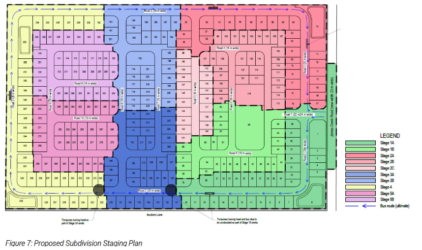
Time and again developers have told the town that clear felling more and more land, as well as draining the marshes, natural flood ways and flood storage land then covering these areas with landfill, will benefit local communities by increasing the supply of housing in the town - that they are in fact 'good neighbours' to have in the community. If the community pushed back these same developers more often than not quickly fell back on their 'rights' as owners of portions of the hundreds of hectares in question and, not infrequently pointed to barely activated development consents they had hoarded as nest eggs until a more favourable political or economic climate developed.

And because all three tiers of government frequently talk in terms of legal ownership of land and its cash value as rateable land, regardless of its aesthetic, environmental, cultural and social value to the community, towns like Yamba at the mouth of the Clarence River often get sucked into responding in terms of the degree to which overdevelopment within long established urban precincts impacts on property ie., loss, damage and/or reduced amenity. 

It's understandable. Like many other coastal towns, a good many Yamba residents are home and/or business property owners themselves.

However, this conversation needs to be firmly turned away from an almost bloodless actuarial view of potential property losses and a new thread has to enter the argument - risk to the life, health and wellbeing of the town population on a individual and collective level.

Because is not just property or lifestyle that will be affected as the climate change risks increase.  

Therefore, all three tiers of government as well as property developers and those contracted to assist the progress of their development applications, need to be forced to face the potential for loss of life, injury and chronic illness if they proceed with political agendas and commercial aspirations on a 'business as usual basis'. 

Yamba, along with the entire east coast of Australia, is facing a rising level of risk because: 

Australia's climate is now on average 1.44°C(± 0.24°C) hotter than it was in 1910 with 1.0°C of this rise occurring since 1960; 

the surface waters of the ocean which forms the eastern border of the town are becoming warmer; 

the East Australia Current has increased in speed moving further down the NSW coast; 

wave patterns have changed and waves breaking on local beaches and estuary soft shorelines are more erosive;

sea-level rise has commenced;

season of the year patterns are changing

adverse weather events are becoming a fact of life;

and Yamba can no longer boast that it has one of the best climate systems in the world. 

Floods now move through the Lower Clarence River estuary on average once every three years with some intervals between floods being much shorter than that and, out of control bushfires driven by high winds have proven that the town is not immune to the threat of fire. East-Coast Lows batter the town during adverse weather events.

During such events - especially flood events - Yamba can be cut off from the wider Clarence Valley for days to weeks and experience disruptions to its food and medicine supply chains.

To date there is not one piece of state legislation, regulation or instrument which guarantees that ALL these risks are taken into consideration whenever a development application is lodged and progressed to the point of denial or consent.

Every battle against inappropriate development in coastal towns like Yamba has to be fought on a case by case basis and, again like Yamba, fought in towns whose topographies are being reshaped time and time again with no overarching understanding on the part of decisionmakers of potential consequences of their actions. 

When Yamba asks local government about safety in times of natural disaster it holds aloft a leaflet with a cry of "Nothing to worry about!" or words to that effect. Then tells residents that they should either 'self evacuate' (leave town ahead of its one road to the outside world being cut), 'shelter in place' (stay at home), go to stay with unspecified family or friends on the only high ground in the town - Pilot Hill with its mix of approx. 200 private and holiday rental dwellings clustered either side of three streets. Alternatively residents are told they could make their way to the ‘evacuation centre’, a low-lying local bowling club where an unspecified person/s will record their details but seemingly do little else.


So knowing that Yamba is vulnerable to almost the full suite of climate change risks - risks being exacerbated right now by inappropriate large scale development consents - who in this small town surrounded on all sides by bodies of water might be the most vulnerable?

How does Yamba bring this range of personal vulnerability to the notice of those overly complacent federal, state and local government decision makers?


A Brief Outline of Demographic Characteristics Which Potentially Indicate Vulnerable Persons within the town boundaries of Yamba, NSW, during an Adverse Weather Event caused by Bushfire or Riverine Flooding which may be intensified by Ocean Storm Surge or Stormwater Inundation.


Based on data collected by Australian Bureau of Statistics on CENSUS NIGHT, 10 August 2021, spatial information from id.com.au and Yamba Floodplain Risk Management Study 2008.


Yamba township is approx. 16.92 sq. kilometres in area with a current population density of 376.9 persons per sq. kilometre.


At all times there is one road acting as access and egress for the Yamba resident population and it is a designated evacuation route in times of bushfire or flood. This road along its length is at its lowest point 1.4mAHD and highest point 2mAHD. Note: Australian Height Datum (AHD) expressed as mAHD indicates height in metres above mean sea level. 


There are recognised difficulties to safe evacuation in and from Yamba in times of Lower Clarence River flooding:


These are likely to be high on account of:

the distance to high ground,

Yamba Road will be cut early making access difficult,

the roads will quickly be inundated by up to 1 m depth or

greater,

the emergency services (SES, Police) will be “stretched”

answering calls throughout the area.”

[Webb, McKeown & Associates, October 2008]


Three significant flood ways taking water from the southern sections of the town to the Clarence River are now either partially built upon, impeded by poorly designed infrastructure or in the process of being blocked by hectares of new land fill.


There are within Yamba:

  • est. 2,747 occupied residential dwellings housing 6,405 men, women & children;

  • est. 875 lone person households in Yamba & another 1,191 two-person family households;

  • est. 273 lone parent households;

  • at least 136 residential dwellings with no car;

  • est. 625 households without an internet connection at the dwelling. Note: Based on 2016 Census data as this question was not asked in Census 2021.

  • est. 758 private dwellings being rented, excluding holiday rentals;

  • est. 49 social housing properties being rented – 17 freestanding houses, 32 townhouses/duplex units;


  • On the basis of vulnerable age groupings:

(i) 830 children aged between 0-14 years of age

(ii) 2,414 adults aged between 65-100+ years of age;


  • On the basis of self-reported chronic health conditions:

2,482 persons with between 1 and 3 or more chronic conditions, including

(i) est. 71 children between 0-14 years of age with one or two health conditions

(ii) est. 200 adults aged between 65-85+ years of age with between one and three or more chronic health conditions:

Note: the range of long-term health conditions include but are not restricted to arthritis, asthma, cancer, dementia, diabetes, heart disease, kidney disease, lung conditions, stroke and mental health.


  • On basis of possible inability to finance their own self-evacuation:

402 households with weekly family incomes of $0-$499 dollars, including

(i) est. 105 family households

(ii) est. 302 lone person & group households;


  • the est. 300-1,000+ visitors staying in the town's hotel, motels, caravan parks, holiday rental accommodation who may be unfamiliar with the topography or road network in Yamba if/when required to seek safe shelter.


A word Premier Perrottet.....

Mr. Perrott, when heavy rainfall and major to extreme flooding events occurred earlier this year in the Northern Rivers region from Clarence Valley to the Qld-NSW border, members of your government - including yourself - called much of what happened "an unprecedented event, an unprecedented situation"

But that is not really an accurate description is it?


It was a predictable event and a predicted situation.


Time and time again the United Nations has warned Australia that it was going to be the first continent to face the full force of climate change impacts. Successive NSW state governments have been aware of the rising level of risk since the 1990s.

You have been a member of the NSW Division of the Liberal Party since 2002, a member of the NSW Parliament and a member of the NSW Coalition Government since March 2011 and, a minister in that government since April 2014. You were NSW Treasurer for 4 years, 8 months, 6 days and went on to be state premier these last eleven months.

I have never heard anyone suggest that you were someone of limited intelligence. So there is no way you had not noted the increased risk of coastal erosion, bushfire and flood along the 1,973km long and 100km wide NSW mainland coastal zone, particularly in the last two decades. 

However, like many in positions of power before you Mr. Perrottet, you have ignored the situation and refused to face the issue of what that meant in terms of physical protection of the population. Or confronted the need to instigate reforms to land use as well as to planning legislation, regulations and instruments, in order to better reflect the circumstances of a society living in a changing climate.

As premier your electorate is the entire state. It's long past time you started to genuinely represent all those most vulnerable to climate change induced fire, storm and flood in that very large electorate - not just the NSW Liberal Party, foreign investors, big business, land speculators, property developers, political donors and your deeply suspect coalition partner, the NSW Nationals.


BRIEF BACKGROUND 

A handful of not so fun facts for Yamba residents  


Matters that state government, local government and regional planning panels should consider (but more often barely notice in passing) before granting consent for large scale residential developments along the NSW coastal zone.


Take Yamba for instance, bounded by the Clarence River estuary and Pacific Ocean...


Probable Maximum Flood (PMF). The largest flood that could conceivably be expected to occur at a particular location, usually estimated from probable maximum precipitation. The PMF defines the maximum extent of flood prone land, that is, the floodplain.

[NEW SOUTH WALES STATE FLOOD PLAN GLOSSARY February 2018]


Evacuation

1. Reliable access for pedestrians or vehicles required during a 100 year flood to a publicly accessible location above the PMF”

[RESIDENTIAL ZONES DEVELOPMENT CONTROL PLANeffective from 23 Dec 2011 , FLOODPLAIN MANAGEMENT CONTROLS, LOWER CLARENCE RIVER FLOODPLAIN, YAMBA FLOODPLAIN & OTHER FLOODPLAINS]......


Approach to Yamba Bowling Club for most of Yamba population will be blocked by 1-in-100yr Flood at 2.09-2.2m & Extreme Flood at 3.56-3.68m. [https://maps.clarence.nsw.gov.au/intramaps97/]


In both flood types Yamba will be isolated from the wider Clarence Valley by floodwaters for a matter of days or weeks....

Thursday 1 September 2022

Apology to "North Coast Voices" readers


Due to illness North Coast Voices will not be posting again until Friday, 9 September 2022.