Showing posts with label rainfall. Show all posts

Sunday 6 December 2020

Water Security State of Play: NSW Northern Rivers December 2020


As of 26 November 2020 an estimated 80.5 per cent of the NSW Northern Rivers region was not in drought. However, 1 per cent of the region was in full-blown drought, another 10 per cent drought affected and 8.2 per cent recovering, according to the NSW Dept. of Primary Industries.


By 2 December urban water supply in the region was coping but beginning to fall markedly. 


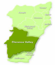
Clarence Valley Council sources its urban water from the Shannon Creek Dam and the Nymboida River Weir. Currently Shannon Creek Dam is at 84 per cent capacity and water flow at Nymboida Weir is well below safe extraction level. Level One water restrictions are in place across the valley.


Ballina Shire Council, Byron Shire Council, Lismore City Council and Richmond Valley Council all principally source their urban water through Rous County Council. The two dams in this cluster are currently at 90 per cent (Rocky Creek) and 89 per cent (Emigrant Creek). With Mullumbimby in Byron Shire sourcing its water from council’s own Laverty’s Weir. Everyday water restrictions apply in all four local government area ie., recommended water use of 160 litres per person per day.


Kyogle Shire Council draws its urban water from a weir on the Richmond River, a natural weir pool on Tooloom Creek and the small Petrochilos Dam with under gravel pump extraction from nearby Peacock Creek. Level One water restrictions are in place across the shire.


Toonumbar embankment dam on Iron Pot Creek about 30 kilometres west of Kyogle was at 55.7 percent of capacity on 30 November 2020.


Tweed Shire Council draws its urban water from the freshwater section of the Tweed River at Bray Park Weir, Clarrie Hall Dam and the weir pool on Tyalgum Creek (Oxley River). Due to low rainfall the Tyalgum district is now on Level Two water restrictions.


The Australian Bureau of Meteorology rainfall and temperature predictions for January to March 2021 show that though the rest of summer may be hot across much of the Northern Rivers region there is reason to hope that rainfall will be adequate to meet our needs.


Thursday 13 February 2020

Tropical Cyclone Uesi predicted to cause damaging seas along Australia's east coast as it weakens


Tropical Cyclone Uesi at Category Two level, Monday 10 February 2020


The Tropical Cyclone Warning Centre Port Vila, Vanuatu, has this particular cyclone tracking south west towards south-east Qld and the NSW North Coast as it weakens.

Weatherzone reported on 10 February 2020 that:

At this stage, there is a fair bit of uncertainty around the movement of this system from Thursday onwards, with a range of plausible scenarios. 
Some forecast models suggest that Uesi will move towards the southwest on Thursday and Friday, which would allow it to move closer to Australia's east coast towards the end of the week. If this happens, the remnants of Tropical Cyclone Uesi, most likely in the form of an extra-tropical cyclone, could cause direct impacts in eastern NSW or southeast Queensland. These impacts could include large and dangerous surf, strong winds and heavy rain. It's worth pointing out that dangerous wind and rain would only occur if the system gets close enough to the coast, while powerful surf can reach Australia even if the system stays well offshore.


The Weekly Times, 11 February 2020

According to the Fiji Meteorological Service, which is tracking Uesi, its current route should take it in a south-westerly direction towards the coasts of both New South Wales and Queensland. It could enter Australian waters as early as Thursday.

The Australian Bureau of Meteorology also says there is a moderate chance the cyclone could turn southwest towards Australia on Thursday — giving odds of between 20%-50% the storm will enter the Coral Sea’s eastern region.

Issued at 2:37 am AEDT Thursday 13 February 2020. 
Refer to Tropical Cyclone Advice Number 7.

ABC News, 12 February 2020:

Tropical Cyclone Uesi could cause more havoc across the NSW coastline later this week, bringing swells of up to 5 metres. 

The news comes as the clean-up continues after the weekend's wild weather. 

The category three cyclone, which is passing north-east of New Caledonia, will track south-west towards the Tasman Sea and could cause increased swells, wind and rainfall as early as Thursday. 

ABC News weather journalist Graham Creed said the cyclone was expected to come closest to the coast on Friday and Saturday. 

"This may produce large swells, which combined with king tides may cause issues for beach erosion, as well as prolong the potential for locally heavy rainfall in showers and thunderstorms," he said....

The forecast at this stage is for swells of about 2 to 3 metres starting on the north NSW coast on Thursday and increasing to 3 to 5 metres on Friday....

By 8pm this evening, Thursday 13 February Cyclone Uesi will have dropped to a tropical low (while possibly maintaining an intensity equivilant to a Category 2 tropical cyclone) and is expected to sit less than 600km to the east of Tweed Heads as the crow flies.

At 2am Friday 14 February 2020 the tropical low is expected to be sitting further south less than 600km to the east of Moonee Beach.

Late Friday night the low will continue to track south before veering further away from the NSW coastline on Saturday.

SEE BOM ADVICE FOR UPDATES AT 
http://www.bom.gov.au/products/IDQ65231.shtml

*Image from Weatherzone, tracking map from the Australian Bureau of Meteorology & animated satellite image from NOAA Environmental Visualization Laboratory

Wednesday 15 January 2020

Rain predicted across NSW from today but it's not all good news - may be landslips, fallen trees & flash flooding on land burnt by bushfire since August 2019


Tuesday 22 October 2019

A perfect example of the interconnection between river and groundwater in time of climate change and drought


In times of water scaricity in New South Wales, right after the call for dams and more dams, comes the call to sink more bores to supply additional water.

Here is a clear example of why sinking more bores is not the answer to either drought or climate change, as rivers and grounwater are an interconnected system in which no water is 'additional' water.

It is only the same water constanting re-looping from the clouds to the surface to the aquifer to the surface to the clouds and back round again.

When we deplete river and groundwater through overuse not all of the water taken from streams,  rivers and underground aquifers is recoverable by those natural processes which produce rainfall.

Water NSW, media release18 October 2019:

Restrictions imposed on Maules Creek groundwater use

The NSW government has issued a temporary restriction on groundwater usage in the Maules Creek Groundwater Water Source upstream of Elfin Crossing.
The Temporary Water Restriction has been issued under section 324 of the Water Management Act and means that holders of an Aquifer Access Licence must not take water under that licence from the Upper Namoi Zone 11 Maules Creek Groundwater Source, upstream of Elfin Crossing.
This restriction will be in place from 18 October 2019 to 30 June 2020.
The restriction does not apply to;
  • bores accessing groundwater under basic landholder rights, or
  • for the purposes of testing metering equipment.
Due to the severe drought conditions, there has been no river flows at the Maules Creek Avoca East Gauge since March 2018 and the groundwater observation bore levels near Elfin Crossing for 2019 have been the lowest on record.
These low groundwater levels have impacted the ability to access groundwater for stock, domestic and basic landholder rights.
A series of pools adjacent to Elfin Crossing that support local habitat and maintain the natural ecosystem are also being impacted. The continued depletion of these pools has also led to a deterioration of water quality in Maules Creek, which is currently not fit for human consumption.
This temporary restriction will help to maintain the perennial pool levels in Maules Creek and the groundwater levels in the Maules Creek Groundwater Water Source upstream of Elfin Crossing.
For more information on the temporary restriction visit the NSW Department of Planning, Industry and Environment announcement. 

Thursday 29 August 2019

Spring is not likely to bring much joy for those watching the skies for rain and cool weather in NSW


Australian Bureau of Meteorology (BOM), Drought, 7 August 2019: 

Rainfall deficiencies have affected most of the New South Wales, Queensland and South Australian parts of the Murray-Darling Basin since the start of 2017. 

These longer-term deficiencies extend to parts of the New South Wales coast, particularly in the Hunter and Illawarra districts, and to much of the eastern half of South Australia from Adelaide northwards. 

The deficiencies have been most extreme in the northern Murray-Darling Basin, especially in the northern half of New South Wales, where areas of lowest on record rainfall extend from the Great Dividing Range west as far as Dubbo and Walgett. 

Some of the largest rainfall deficiencies have occurred in the upper catchments of some of the major tributaries of the Darling, including the Macquarie, the Namoi-Peel and the Border Rivers. 

The 31 months from January 2017 to July 2019 has been the driest on record averaged over the Murray-Darling Basin (32% below the 1961-1990 average), as well as over the northern Murray-Darling Basin (38% below average) and for the state of New South Wales (33% below average). 

All three regions rank second-driest on record, for the 25 months from July 2017 to July 2019, and the 19 months from January 2018 to July 2019; only the 1900-02 peak of the Federation Drought has been drier. 

The last 31 months have also been the driest on record averaged over the Macquarie-Bogan, Namoi, Gwydir and Castlereagh catchments, with the last three also driest on record for the last 19 months. 

The dry conditions of the last three years have been particularly acute during the cool season, which is important in many regions for generating runoff. 

Rainfall for the period from April to September was less than 50% of average in both 2017 and 2018 in 14 of the 30 rainfall districts of New South Wales. 

In 13 of these 14 districts, rainfall from April 2019 to date is also less than 50% of average. 

The Central Western Plains (North), which encompasses Nyngan, Trangie, Gilgandra and Coonamble, has had less than one-third of its average cool-season rainfall in all three years. 

Another area of longer-term rainfall deficiencies affects Gippsland, in eastern Victoria, and the east coast of Tasmania. Both the West Gippsland and East Gippsland districts have had their driest 31 months on record, with a substantial area of record low rainfall in central Gippsland centred on Sale and Bairnsdale.

Drier and warmer conditions are expected over much of mainland Australia from September through to November 2019, according to BOM

A drier than average spring is likely for most of Australia, except the western coastline and far southeast.

NSW DPI Drought Maps, 26 August 2019:

CDI = Combined Drought Indicator. RI = Rainfall Index. SWI = Soil Water Index. PGI = Pasture Growth Index. DDI = Drought Direction Index


Tuesday 28 August 2018

If you live in a NSW rural/regional area or an outer metropolitan suburb with thick tree cover.....


Now is the time to make or update your bushfire survival plan.

Because the fires have come early this year and intermittant rainfall is unlikely to ease the threat for long.


http://www.bom.gov.au/climate/rainfall/

Crikey.com.au, 16 August 2018:

NSW has declared its earliest total fire ban on record, with hundreds of South Coast residents forced to flee their homes amidst a massive blaze.

The Sydney Morning Herald reports that fire crews battled at least 83 fires across the state, following stronger-than-expected winds, creating fire bans that beat the previous record by two weeks. Compounding problems was the fact that, according to The Daily Telegraph ($), two huge water bombers were not in action because they had not yet arrived from the US ahead of Australia’s summer season.


Australian Government Bureau of Meteorology
New South Wales

Fire Weather Warning for the Greater Hunter, Greater Sydney Region and Illawarra/Shoalhaven fire areas.

Issued at 10:37 am EST on Wednesday 15 August 2018.

Weather Situation
Warm, dry and windy conditions over southeast NSW today ahead of a cold front,
which will pass to the south of the state overnight.

For the rest of Wednesday 15 August:

Severe Fire Danger is forecast for the following fire areas:
Greater Hunter, Greater Sydney Region and Illawarra/Shoalhaven

The NSW Rural Fire Service advises you to:
- Action your Bushfire Survival Plan now.
- Monitor the fire and weather situation through your local radio station,
www.rfs.nsw.gov.au and www.bom.gov.au.
- Call 000 (Triple Zero) in an emergency.

The Rural Fire Service advises that if you are in an area of Severe Fire Danger:
- If you plan to leave finalise your options and leave early on the day
- Only stay if your home is well prepared and you can actively defend it
- Prepare for the emotional, mental and physical impact of defending your
property - if in doubt, leave.
For information on preparing for bushfires go to www.rfs.nsw.gov.au.

No further warnings will be issued for this event, but the situation will
continue to be monitored and further warnings issued if necessary.

For up-to-date information for your local area see NSW Rural Fire Service’s  Fire Danger Ratings and Total Fire Bans and Fires Near Me.