Showing posts with label BOM. Show all posts

Wednesday 1 September 2021

Latest Bureau Of Meteorology Climate Driver Update, Australian Daily Extreme Temperatures Jan-Aug 2021 & Spring rainfall predictions


Issued 31 August 2021


Tropical Pacific Ocean likely to cool, but remain ENSO-neutral


The El Niño–Southern Oscillation (ENSO) is currently neutral. Sea surface temperatures (SSTs) in the central tropical Pacific Ocean are near average, despite slowly cooling over the past two months. Waters beneath the surface are slightly cooler than average.


While most models indicate SSTs in the central tropical Pacific are likely to continue cooling over the coming months, ENSO-neutral is favoured to persist. Only two of the seven models surveyed suggest SSTs will remain cool for long enough to be considered a La Niña event. This cooling of the tropical Pacific may be contributing to the wetter than median climate outlooks in Australia.


Most climate models predict the negative Indian Ocean Dipole (IOD) event will persist through the southern hemisphere spring, despite current values rising marginally above the −0.4 °C threshold. Stronger-than-usual easterly winds across the tropical eastern Indian Ocean over the last three weeks have weakened the IOD event, however, this is most likely to be temporary. A majority of the five climate models surveyed by the Bureau predict the negative IOD will persist into November. A negative IOD increases the chance of above average winter–spring rainfall for much of southern and eastern Australia.


The Madden–Julian Oscillation (MJO) is currently in the western Indian Ocean, where it has remained since early August. This phase of the MJO typically sees increased cloudiness over the Southeast Asian parts of the Maritime Continent and eastern Indian Ocean, along with enhanced easterly wind anomalies, which may have acted to weaken the negative IOD. Forecasts generally indicate a weak MJO will progress eastwards across the Indian Ocean in the coming week.


The Southern Annular Mode (SAM) index has been positive over the past week and is forecast to remain so for the next fortnight. A positive SAM typically has a drying influence on south-west and south-east Australia during winter, and enhances chances of above average rainfall over much of New South Wales during spring.


Climate change continues to influence Australian and global climate. Australia's climate has warmed by 1.44 ± 0.24 °C over 1910–2019, while southern Australia has seen a reduction of 10–20% in cool season (April–October) rainfall in recent decades.


Next Climate Driver Update expected on 14 September 2021.Climate Driver


Daily maximum temperature extremes graph for Australia: 1 January to 31 August 2021


Above median spring rainfall likely for eastern two-thirds of Australia


Issued: 26 August 2021


  • Rainfall for spring (September to November) is likely to be above median for south-east WA, the NT, SA, Queensland, NSW, Victoria and eastern Tasmania (chance of exceeding median is greater than 60%). Much of the eastern States show a greater than 80% chance, as does eastern parts of the NT and SA. Conversely, parts of western WA and south-west Tasmania are likely to have below median rainfall (chance of exceeding the median is less than 40%).


  • The pattern for the months of September and October is similar to the spring outlook, though the likelihood of exceeding the median rainfall is not as high in the eastern two-thirds of the country, and extends further west into eastern WA for September.


  • Rainfall for October to December is likely to be above median for the eastern half of Australia, and below median for north-west WA.


  • Past accuracy (Opens in new window) for September to November rainfall is high to very high for most of the eastern two-thirds of Australia, with moderate accuracy for central and eastern Victoria, most of WA and the central NT shifting to low accuracy for central areas of WA.


BOM September 2021 rainfall outlook: Taree to the NSW-Qld border


Tuesday 12 January 2021

Yes, it's been a bit wet recently...


On Thursday 7 January 2021 the Yamba Pilot Station recorded a total of 34.4mm of rain and this was followed the next day by rainfall of 22.8mm.


Up to 11 January 2021 the pilot station recorded a total of 81.9mm of rain. 


The Daily Telegraph, 11 January 2021:


Last year was a hot and wet one for the Clarence Valley, with some rainfall records broken and above average temperatures recorded.


According to the Bureau of Meteorology, Wooli Beach set a new record in total rainfall, with 2201.6mm recorded in 2020, eclipsing the previous record of 2004.8mm in 2011.


Grafton Research Station also had its wettest year since 1959, with 1600.2mm recorded.


Yamba’s Pilot Station had 1746.6mm of rainfall in 2020, which was about 20 per cent higher than the average annual rainfall total for the station.


Grafton Airport AWS had a total of 1527.8mm last year, a 33 per cent increase on the station’s rainfall average.


Meanwhile, Grafton experienced its third driest November since 1917 with just 7mm of rain recorded, immediately followed by its wettest December in 164 years of data, recording 513mm.


BOM senior climatologist Dr Lynette Bettio said for NSW, rainfall was above average for most of the state.


That was a real contrast to what we saw in 2019 with those extreme drought conditions across the state,” she said.


Starting to relieve some of those drought conditions we saw good rainfall at the start of the year which helped out with those winter crops but we do still need to see more rainfall in the coming months to really relieve that long-term drought that we did see in 2019 but it was a good start…..


Thursday 13 February 2020

Tropical Cyclone Uesi predicted to cause damaging seas along Australia's east coast as it weakens


Tropical Cyclone Uesi at Category Two level, Monday 10 February 2020


The Tropical Cyclone Warning Centre Port Vila, Vanuatu, has this particular cyclone tracking south west towards south-east Qld and the NSW North Coast as it weakens.

Weatherzone reported on 10 February 2020 that:

At this stage, there is a fair bit of uncertainty around the movement of this system from Thursday onwards, with a range of plausible scenarios. 
Some forecast models suggest that Uesi will move towards the southwest on Thursday and Friday, which would allow it to move closer to Australia's east coast towards the end of the week. If this happens, the remnants of Tropical Cyclone Uesi, most likely in the form of an extra-tropical cyclone, could cause direct impacts in eastern NSW or southeast Queensland. These impacts could include large and dangerous surf, strong winds and heavy rain. It's worth pointing out that dangerous wind and rain would only occur if the system gets close enough to the coast, while powerful surf can reach Australia even if the system stays well offshore.


The Weekly Times, 11 February 2020

According to the Fiji Meteorological Service, which is tracking Uesi, its current route should take it in a south-westerly direction towards the coasts of both New South Wales and Queensland. It could enter Australian waters as early as Thursday.

The Australian Bureau of Meteorology also says there is a moderate chance the cyclone could turn southwest towards Australia on Thursday — giving odds of between 20%-50% the storm will enter the Coral Sea’s eastern region.

Issued at 2:37 am AEDT Thursday 13 February 2020. 
Refer to Tropical Cyclone Advice Number 7.

ABC News, 12 February 2020:

Tropical Cyclone Uesi could cause more havoc across the NSW coastline later this week, bringing swells of up to 5 metres. 

The news comes as the clean-up continues after the weekend's wild weather. 

The category three cyclone, which is passing north-east of New Caledonia, will track south-west towards the Tasman Sea and could cause increased swells, wind and rainfall as early as Thursday. 

ABC News weather journalist Graham Creed said the cyclone was expected to come closest to the coast on Friday and Saturday. 

"This may produce large swells, which combined with king tides may cause issues for beach erosion, as well as prolong the potential for locally heavy rainfall in showers and thunderstorms," he said....

The forecast at this stage is for swells of about 2 to 3 metres starting on the north NSW coast on Thursday and increasing to 3 to 5 metres on Friday....

By 8pm this evening, Thursday 13 February Cyclone Uesi will have dropped to a tropical low (while possibly maintaining an intensity equivilant to a Category 2 tropical cyclone) and is expected to sit less than 600km to the east of Tweed Heads as the crow flies.

At 2am Friday 14 February 2020 the tropical low is expected to be sitting further south less than 600km to the east of Moonee Beach.

Late Friday night the low will continue to track south before veering further away from the NSW coastline on Saturday.

SEE BOM ADVICE FOR UPDATES AT 
http://www.bom.gov.au/products/IDQ65231.shtml

*Image from Weatherzone, tracking map from the Australian Bureau of Meteorology & animated satellite image from NOAA Environmental Visualization Laboratory

Tuesday 10 December 2019

Even the Australian Bureau of Meteorology rain radars are finding they are impacted by NSW bushfires


This tweet is from the Director of ABC News on 6 December 2019:

Sunday 23 December 2018

Australia 2018: State of the Climate


Australian Bureau of Meteorology, State of the Climate 2018, December 2018:

“Australia's weather and climate are changing in response to a warming global climate. Australia has warmed just over 1 °C since 1910, with most warming since 1950. This warming has seen an increase in the frequency of extreme heat events and increased the severity of drought conditions during periods of below-average rainfall. Eight of Australia’s top ten warmest years on record have occurred since 2005.

The year-to-year changes in Australia’s climate are mostly associated with natural climate variability such as El Niño and La Niña in the tropical Pacific Ocean and phases of the Indian Ocean Dipole in the Indian Ocean. This natural variability now occurs on top of the warming trend, which can modify the impact of these natural drivers on the Australian climate.

Increases in temperature are observed across Australia in all seasons with both day and night-time temperatures showing warming. The shift to a warmer climate in Australia is accompanied by more extreme daily heat events. Record-warm monthly and seasonal temperatures have been observed in recent years, made more likely by climate change.


Report at a glance

The Bureau of Meteorology and CSIRO play an important role in monitoring, analysing and communicating observed changes in Australia's climate.
This fifth, biennial State of the Climate report draws on the latest monitoring, science and projection information to describe variability and changes in Australia’s climate. Observations and climate modelling paint a consistent picture of ongoing, long term climate change interacting with underlying natural variability.
These changes affect many Australians, particularly the changes associated with increases in the frequency or intensity of heat events, fire weather and drought. Australia will need to plan for and adapt to some level of climate change. This report is a synthesis of the science informing our understanding of climate in Australia and includes new information about Australia’s climate of the past, present and future. The science underpinning this report will help inform a range of economic, environmental and social decision-making and local vulnerability assessments, by government, industry and communities.

Key points

Australia

·         Australia's climate has warmed just over 1 °C since 1910 leading to an increase in the frequency of extreme heat events.
·         Oceans around Australia have warmed by around 1 °C since 1910, contributing to longer and more frequent marine heatwaves.
·         Sea levels are rising around Australia, increasing the risk of inundation.
·         The oceans around Australia are acidifying (the pH is decreasing).
·         April to October rainfall has decreased in the southwest of Australia. Across the same region May–July rainfall has seen the largest decrease, by around 20 per cent since 1970.
·         There has been a decline of around 11 per cent in April–October rainfall in the southeast of Australia since the late 1990s.
·         Rainfall has increased across parts of northern Australia since the 1970s.
·         Streamflow has decreased across southern Australia. Streamflow has increased in northern Australia where rainfall has increased.
·         There has been a long-term increase in extreme fire weather, and in the length of the fire season, across large parts of Australia.

Global

·         Concentrations of all the major long-lived greenhouse gases in the atmosphere continue to increase, with carbon dioxide (CO2) concentrations rising above 400 ppm since 2016 and the CO2 equivalent (CO2-e) of all gases reaching 500 ppm for the first time in at least 800,000 years.
·         Emissions from fossil fuels continue to increase and are the main contributor to the observed growth in atmospheric CO2.
·         The world’s oceans, especially in the southern hemisphere, are taking up more than 90 per cent of the extra energy stored by the planet as a result of enhanced greenhouse gas concentrations.
·         Global sea level has risen by over 20 cm since 1880, and the rate has been accelerating in recent decades.
·         Globally averaged air temperature has warmed by over 1 °C since records began in 1850, and each of the last four decades has been warmer than the previous one.

Future

Australia is projected to experience:
·         Further increases in sea and air temperatures, with more hot days and marine heatwaves, and fewer cool extremes.
·         Further sea level rise and ocean acidification.
·         Decreases in rainfall across southern Australia with more time in drought, but an increase in intense heavy rainfall throughout Australia.

Friday 20 July 2018

Too warm, too dry as Winter draws closer to Spring in Australia 2018


Warmer days and nights favoured for August–October

August to October days and nights are likely to be warmer than average for most of the country, with high chances (greater than 80%) in eastern Victoria and NSW, and southern Tasmania.

Days and nights in August are likely to be warmer than average for most of Australia, with high chances (greater than 80%) of warmer days in the southeast.

Historical accuracy for August–October maximum temperatures is moderate for eastern and northern parts of Australia, as well as southern WA. Elsewhere, accuracy is low to very low. Historical accuracy for minimum temperatures is moderate for the northern half of Australia, SA, and Tasmania, but low to very low elsewhere.

Temperature - The chance of above median maximum temperature for August to October


Drier than average August–October likely in northeast and southeast mainland
August to October is likely to be drier than average in Victoria, NSW, southeast SA and northeast Queensland

The August outlook shows most of Victoria, NSW and Queensland are likely to be drier than average.

Historical outlook accuracy for August to October is moderate over most of the country, except for interior WA, where accuracy is low to very low.

Rainfall - Totals that have a 75% chance of occurring for August to October

Drought

June rainfall was below average for most of Australia, and very much below average for parts of the east coast

The start of the southern wet season has been drier than average

Rainfall deficiencies persist in both the east and west of the country, increasing in the east at the 6- and 15-month timescales, and along the west coast at the 15-month timescale

Lower-layer soil moisture was below average for June across most of New South Wales, the southern half of Queensland, South Australia, the Northern Territory, the Kimberley and the south of Western Australia

Soil Moisture

Soil moisture in the lower layer (from 10 cm to 100 cm deep) for June decreased over eastern Australia, and increased over parts of northwest Western Australia following above average rainfall for June.

Lower-layer soil moisture was below average for the Kimberley and southern Western Australia away from the west coast, most of South Australia and the Northern Territory, New South Wales and eastern Victoria, southern and eastern Queensland south of a line between Birdsville and Townsville, and along the coastal fringe of eastern Cape York Peninsula.

Map of lower level soil moisture for the previous month

NSW Dept. of Primary Industries, NSW State Seasonal Update - June 2018. Click on map to enlarge:


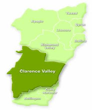
Tweed, Richmond, Kyogle, Lismore, Byron Bay, Ballina, Clarence Valley local government areas, as at 15 July 2018 according to Combined Drought Indicator:


The entire Northern Rivers region is considered drought affected. 

Tuesday 9 January 2018

Ever wondered why you feel much hotter or colder than the temperature gauge indicates?


Australian Bureau of MeteorologyThermal Comfort observations, January 2018:

We often use the air temperature as an indicator of how comfortable we will feel when involved in sports or other physical activities. However, the air temperature is only one factor in the assessment of thermal stress. In climates where other important factors, principally humidity, can vary widely from day to day, we need more than just the temperature for a more realistic assessment of comfort. However it is useful to be able to condense all the extra effects into a single number and use it in a similar way to the way we used the temperature. The Wet Bulb Globe Temperature (WBGT) and the Apparent Temperature are indices which attempt to do this….

Human thermal comfort depends on environmental and personal factors. The four environmental factors are airflow (wind), air temperature, air humidity, and radiation from the sun and nearby hot surfaces. The personal factors are the clothing being worn and the person's level of physical activity. Thermal sensation is also significantly affected by acclimatisation/adaptation: people living in hot climates have been shown to be comfortable at higher temperatures than those living in cooler climates.

In hotter conditions the body must shed heat to maintain thermal equilibrium. The cooling effect of evaporation of sweat from the skin becomes an important factor. The efficiency of this cooling depends on the humidity of the air. A high humidity reduces the effectiveness of evaporative cooling significantly. The amount of clothing will also affect this cooling efficiency due to its restriction of the air flow over the skin. Fabrics with low vapour permeability (those that don't "breathe") will increase the humidity of air near the skin.

In colder conditions, the body must either reduce heat loss (eg by taking shelter from the wind) or increase heat production, for example, by greater physical activity. In these conditions evaporation and air humidity are relatively unimportant factors. The cooling of the exposed parts of the body by the wind now becomes the most important external factor affecting thermal balance.

The effect of radiation is important under all temperature conditions. Excess radiation always acts to increase the heat load on a person. This can be of assistance under cold conditions, but under hot conditions it's an extra heat load that must be shed.

Of the four environmental factors, wind and radiation are very much influenced by the immediate surroundings. For example, wind speed is reduced by the sheltering effect of belts of trees and solar radiation is affected by short term localised phenomena such as cloudiness. If these factors are to be used as inputs, they are best measured on location, as values can vary significantly over relatively short distances. The remaining two factors (temperature and humidity) are less spatially variable and can be used to give an indication of the general comfort level of a region.

In order to make comparisons between areas, it is convenient to combine the effect of temperature and humidity into one index. This does not mean we can ignore the other environmental and non-environmental factors, but adjustments to the index value, either up or down, can be made to take them into account.

Most people use the temperature alone to provide some guide to the level of comfort. Generally this is quite reasonable because humidity doesn't often vary a lot, particularly in the tropics. However people moving from a less humid to more humid environment will immediately notice the effect of the greater humidity. In many sub-tropical regions of Australia the humidity is usually quite low, but occasionally can become quite high, again reducing comfort to those people not acclimatised.

The Wet Bulb Globe Temperature (WBGT) and Apparent Temperature (AT) are just two methods of combining temperature and humidity into a single number. In fact the real WBGT is also affected by wind and radiation, but the WBGT provided by the Bureau is only an approximation, which ignores variations of wind and radiation (light winds and fairly sunny conditions assumed). The AT can also be extended to take wind and solar radiation into account as well, though generally this is not done. In the AT values provided by the Bureau, wind is taken into account, but not solar radiation. Other indices such as the Physiologically Equivalent Temperature (PET) and the Predicted Mean Vote (PMV) can also be used.

An example of how this works on the ground:


To check thermal stress in your area on any given day go to Thermal Comfort observations index for each State or go directly to Thermal Comfort observations in each State NSW & ACTVicQldWASATasNT.

Thursday 9 March 2017

As Australia enters Autumn 2017 eyes turn to the skies


Bureau of Meteorology (BOM), media release, 28 February 2017:

The El Niño-Southern Oscillation (ENSO) remains neutral. However, recent changes in both the tropical Pacific Ocean and atmosphere, and climate model outlooks surveyed by the Bureau, suggest the likelihood of El Niño forming in 2017 has risen. As a result, the Bureau's ENSO Outlook status has been upgraded to El Niño WATCH, meaning the likelihood of El Niño in 2017 is approximately 50%.

All atmospheric and oceanic indicators of ENSO are currently within neutral thresholds. However, sea surface temperatures have been increasing in the eastern Pacific Ocean and are now warmer than average for the first time since June 2016, while the Southern Oscillation Index (SOI) has been trending downwards.

Seven of eight international models surveyed by the Bureau indicate steady warming in the central tropical Pacific Ocean over the next six months. Six models suggest El Niño thresholds may be reached by July 2017. However, some caution must be taken at this time of year, with lower model accuracy through the autumn months compared to other times of the year.

El Niño is often associated with below average winter–spring rainfall over eastern Australia and warmer than average winter–spring maximum temperatures over the southern half of Australia.

The Indian Ocean Dipole (IOD) has little influence on Australia from December to April. Current outlooks suggest a neutral IOD may persist until the end of autumn.

Climate outlooks – monthly and seasonal Issued: 23 February 2017 – Next issue: 30 March 2017:

Climate outlook overview
Autumn (March to May) rainfall is likely to be below average over the southern two-thirds of Australia.
March is likely to be hotter and drier than average across most of Australia, except the far north and west.
Warmer autumn days and nights are likely across most of Australia, except northwest Australia where days and nights are likely to be cooler than average.
The drier than average outlooks are likely a result of forecast higher than normal pressure across western and southern Australia, meaning fewer rain-bearing systems are likely to cross the coast (see the Climate Influences section for more detail).

NSW Forecast – chance of exceeding median maximum temperature in March to May 2017:

NSW Forecast – chance of above median rainfall in March to May 2017:

The Conversation, 1 March 2017:

Crop yields around Australia have been hard hit by recent weather. Last year, for instance, the outlook for mungbeans was excellent. But the hot, dry weather has hurt growers. The extreme conditions have reduced average yields from an expected 1-1.5 tonnes per hectare to just 0.1-0.5 tonnes per hectare.

Sorghum and cotton crops fared little better, due to depleted soil water, lack of in-crop rainfall, and extreme heat. Fruit and vegetables, from strawberries to lettuce, were also hit hard.

But the story is larger than this. Globally, production of maize and wheat between 1980 and 2008 was 3.8% and 5.5% below what we would have expected without temperature increases. One model, which combines historical crop production and weather data, projects significant reductions in production of several key African crops. For maize, the predicted decline is as much as 22% by 2050.

ABC News, 17 February 2017:

The impact of several heatwaves so far this year will be felt for some time by primary producers around Australia.
From crop damage, to livestock stress, the impact of these extreme temperatures is yet to be fully understood.
Meanwhile, farmers and wholesalers say they have had to come up with innovative methods of cooling their animals and produce.
But they are not the only ones to feel the impact of the heat; consumers will feel it in their wallets and in the quality available.

Wednesday 11 January 2017

Yes, it was hot last year and no, 2017 is not going to be much better


Australian Bureau of Meteorology (BOM), media release, 5 January 2016

2016 a year of extreme weather events

It was a year of extreme weather events, wetter than average overall, and the fourth-warmest on record for Australia, according to the Bureau of Meteorology’s Annual Climate Statement 2016 released today.
Assistant Director Climate Information Services, Neil Plummer, said 2016 was an eventful year with significant climate drivers affecting the country’s weather.

“The year started off very warm and dry, with bushfires in Victoria, Tasmania and Western Australia, and a nation-wide heatwave from late February to mid-March. We had our warmest autumn on record partly due to a very strong 2015–16 El Niño," Mr Plummer said.

“In May the El Niño broke down and the dry start was followed by record wet from May to September as a negative Indian Ocean Dipole developed, with ocean waters warming to the northwest of Australia.

“Widespread, drought-breaking rains led to flooding in multiple states. Even northern Australia saw widespread rainfall, during what is usually the dry season, greening regions that had been in drought for several years,” he said.
For Australia as a whole, annual rainfall was 17 per cent above average.

Notable events during the wet period included an East Coast Low in June, causing flooding down the east coast of Australia to Tasmania, and damaging coastal erosion in New South Wales. There were also significant storm and wind events which affected the southeast.
In the Murray–Darling Basin, already wet soils and full rivers meant rain caused flooding in many areas throughout September and October.
Australia was warmer than average in 2016, with a national mean temperature 0.87 °C above average, and it was the fourth-warmest year on record.
Sea surface temperatures around Australia were the warmest on record in 2016, and were 0.77°C above average.
The World Meteorological Organization figures have announced that 2016 is very likely to have been the warmest year on record for global mean temperatures.

The Annual Climate Statement is available on the Bureau's website.

Quick facts: Major weather events in 2016

§  Very large fires in northwest Tasmania during January and February following an extended dry period; about 123 800 ha burnt, mostly in remote areas
§  Significant flooding in Tasmania in January
§  Significant fires at the start of the year near Wye River on the Great Ocean Road in Victoria, and in southwest Western Australia affecting Yarloop and Waroona
§  An East Coast Low caused major coastal flooding and erosion in New South Wales in early June, with flooding also affecting Victoria and large areas of Tasmania
§  Flooding occurred from June to September in western, central and southern Queensland following the State’s second-wettest winter on record
§  Periods of flooding in inland New South Wales and northern and western Victoria during September and October
§  Supercell thunderstorms caused extensive damage across southeast Australia and parts of southeast Queensland during early November, with widespread reports of golf-ball sized hail
§  Severe thunderstorms and a tornado outbreak caused widespread damage in South Australia during late September
§  On 21 November, lightning storms associated with a strong and gusty change ignited grassfires across northern Victoria, caused damage across parts of Victoria, and along with a high pollen count, triggered thousands of incidents of thunderstorm asthma.
§  A tropical low at the end of the year brought exceptional December rainfall to a number of regions between the northwest of Australia and the southeast, with some flooding and flash flooding resulting in the Kimberley, around Uluru in Central Australia, and around Adelaide, Melbourne and Hobart.

~~~~~~~~~~~~~~~~~~~~~~~~~~~~~~~~~~~~~~~~~~~~~~~~~~~~~~~~~~~


January to March rainfall is likely to be below average in parts of eastern Australia and above average in northwest and central WA.

The January outlook shows a drier month in the east, while a wetter January is likely in northwest WA and western Tasmania.

Warmer days and nights are likely across eastern and northern Australia, with cooler days and nights more likely in Tasmania and southwest WA.

The outlooks are influenced by the Southern Annular Mode (SAM), as well as warmer waters surrounding northern Australia. SAM is currently negative, and forecast to remain negative through January (a negative SAM means Australia experiences higher pressures than normal, resulting in reduced rainfall and higher temperatures during the summer months). The warmer than normal sea surface temperatures surrounding northern Australia are likely to enhance rainfall in northwest WA (see the Climate Influences section for more detail).


Heatwave Situation for Wednesday, Thursday, & Friday (3 days starting 11/01/2017)
Heatwave will persist over similar areas in central and eastern Australia. Severe to extreme heatwave conditions are forecast for much of southern Queensland, northern NSW, northeastern SA and the far southeast of NT.